Town El Arenal, Hidalgo Municipality of El Arenal Hidalgo Mountain Corridor Comarca Minera Geopark Mezquital Valley
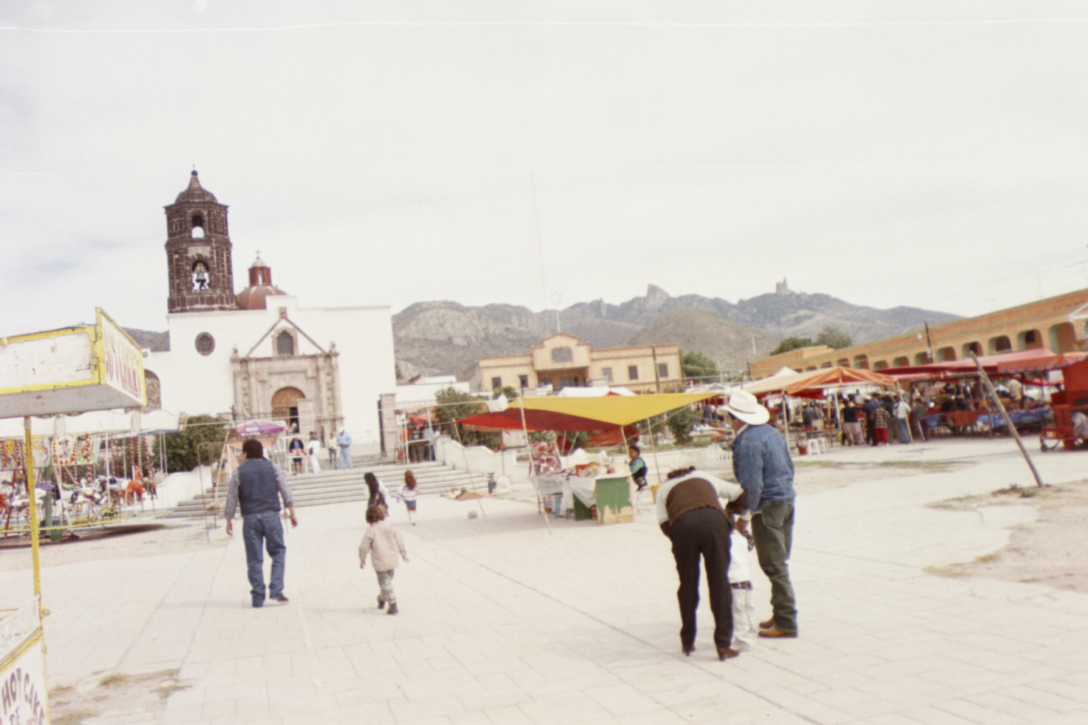
Municipal seat at 2,031 m with the Señor de las Maravillas shrine, a 55 m cross, and access to Los Frailes and San Jerónimo dam.
From Pachuca: 30 min by car (30 km by road) How to get there ↓
Near here
See everything nearby ↓


Plan your visit to El Arenal
Where to stay near El Arenal
Compare hotels, posadas and guest houses in El Arenal.
Tours to El Arenal
Day trips around Mineral del Chico sometimes stop in El Arenal; a tour is the easy way to see it without a car.
 Tours from Zacatlan
Zacatlán Guided Tour walking through the Center
★ 5.0 (2) · From US$8
How to get to El Arenal
- From Pachuca: about 30 min by road (~30 km)
- Nearest airport: Mexico City (Felipe Ángeles) (NLU), 1 h 12 min by car to Mineral del Chico
Links open a partner site. We may earn a commission if you book, at no cost to you.
Tours from Zacatlan, near El Arenal
Tours, prices and ratings from Viator, checked weekly. We may earn a commission if you book.
About El Arenal
El Arenal is named for the sand that abounds there; in Otomi it was known as Mohmu, "heap of sand". Otomi groups lived here from early times and local history is tied to that of Actopan; it became a municipality in 1826. The seat is at 2,031 metres on a Mezquital Valley plain, with a semi-dry temperate climate, about 16 C on average and rain from June to September. It had 3,578 residents in 2020, 18% of the municipality.
The shrine of the Senor de las Maravillas anchors religious life. According to the tourism office, the image reached the region in 1806 wrapped in laurel branches, hence its first name, Senor de los Laureles. Its fair is the Fifth Friday fair; in 2025 it ran 3 to 7 April, with dances, wind bands and a Huastec trio at the Foro Cultural, and stalls of barbacoa, ximbo, garambullo-flower quesadillas and cured pulque. Pilgrims arrive from Tlaxcala, Queretaro, Atotonilco el Grande and Metztitlan, many on foot or horseback wearing flower crowns.
Another landmark is the Cruz Monumental, 55 metres tall and almost 980 tonnes according to Wikipedia. Elsewhere in the municipality, the community of San Jeronimo is the access to Los Frailes, rock formations at 2,896 metres: the walk up from the community takes between an hour and a half and two hours on a trail with steep sections. San Jeronimo dam offers boat rides, guided walks and hanging bridges, and the Piedra del Conejo can be reached from there.
How to get to El Arenal
Drive from Pachuca: 30 min, 30 km
El Arenal is about 29 km northwest of Pachuca on the Pachuca-Actopan road, roughly 25 minutes by car according to Criterio Hidalgo; Wikipedia places the turn-off from federal highway 85. Several departures from Pachuca's Central de Autobuses connect with El Arenal (Criterio Hidalgo); no timetables or fares are published, so confirm at the station. From Mexico City, first reach Pachuca (Futura leaves from Indios Verdes and the Terminal Norte) or Actopan, about 120-125 km, and continue from there. For Los Frailes and the dam, access is through the community of San Jeronimo, outside the seat; during the fair there are two parking areas. Mineral del Chico is about 17 km in a straight line, approx.
Directions to El Arenal on Google Maps
Distances are in a straight line; the road is usually longer.
Links open a partner site. We may earn a commission if you book, at no cost to you.
From the nearest cities to El Arenal
- Pachuca · 30 km by road, 30 min
- Tulancingo · 76 km by road, 1 h 15 min
- Mexico City · 112 km by road, 1 h 40 min
Drive times by road from OpenStreetMap, without traffic or stops. Times marked ~ are estimated from the straight-line distance.
Before you go to El Arenal: hours, prices and tips
- Time needed
- Hike to Los Frailes from San Jeronimo: 1.5 to 2 hours on foot, with steep sections. Criterio Hidalgo · checked Oct 2026
- Best season
- Fifth Friday fair (Senor de las Maravillas): in 2025 3 to 7 April; the date changes each year. Criterio Hidalgo · checked Oct 2026
Hours and prices change, especially around holidays. Each fact links to where we checked it.
Visiting El Arenal: what to see and do
Shrine of the Senor de las Maravillas and its Fifth Friday fair
Cruz Monumental, 55 m tall
Los Frailes, rock formations at 2,896 m (1.5 to 2 h on foot from San Jeronimo)
San Jeronimo dam: boats, hanging bridges and guided walks
Piedra del Conejo, a rock shaped like a rabbit, reachable from the dam
Plan your trip
Places to stay in El Arenal
Compare hotels, posadas, and rentals in and around El Arenal.
Tours & activities
Day trips around Mineral del Chico sometimes stop in El Arenal; a tour is the easy way to see it without a car.
Rental cars
Pick up a car at NLU (Mexico City (Felipe Ángeles)): about 1 h 12 min by road to Mineral del Chico, then 17 km more to El Arenal, on your own schedule.
Flights
The nearest airport with scheduled flights is Mexico City (Felipe Ángeles) (NLU), about 1 h 12 min by road from Mineral del Chico, the base for El Arenal.
Mobile data
Signal can drop away from Mineral del Chico: download a map of the way to El Arenal before you set out, or carry an eSIM with data.
Links open a partner site. We may earn a commission if you book, at no cost to you.
When to go to El Arenal cool
El Arenal shares the climate of Mineral del Chico, 17 km away. The best months to visit are February, March, April, and May.
See the month-by-month climate of Mineral del Chico
Weather in El Arenal now and the next 7 days
Live forecast from Open-Meteo. Chance of rain is the day's highest.
The closest Pueblo Mágico: Mineral del Chico

Mineral del Chico is the Pueblo Mágico closest to El Arenal, with places to stay, food, and more to see.
Also close to
- Real del Monte · Hidalgo · 26 km away
- Huasca de Ocampo · Hidalgo · 33 km away
- Zempoala · Hidalgo · 42 km away
- Metztitlán · Hidalgo · 43 km away
- Teotihuacán · Estado de México · 59 km away
Closest to El Arenal
-
San José Tepenene · Village · 3 km away
-
Actopan · Town · 6 km away
-
El Rincón · Village · 6 km away
-
Presa San Jerónimo · Lake · 6 km away
-
San Jerónimo · Village · 7 km away
-
San Andrés Tianguistengo · Village · 8 km away
-
Leandro Valle · Village · 9 km away
-
La Estancia · Village · 10 km away


Near El Arenal


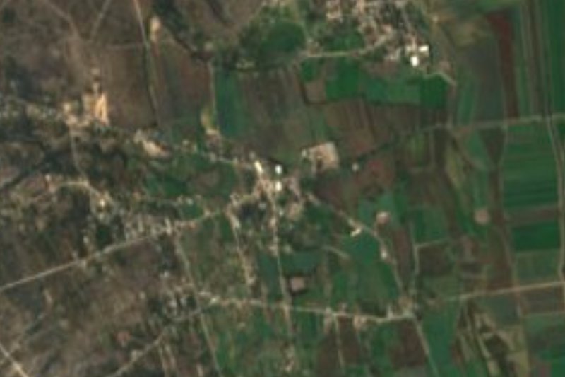


Drive times by road from OpenStreetMap, without traffic. Times marked ~ are estimated from the straight-line distance.
Location from OpenStreetMap. Written by Puebloteca.