

Village Actopan, Hidalgo Municipality of Actopan Hidalgo Mountain Corridor Comarca Minera Geopark Mezquital Valley
Hill village at 2,370 m, about 10 km from Actopan, with its own parish church and 2,500 m-plus hills around it.
From Pachuca: 50 min by car (46 km by road) How to get there ↓
Near here
See everything nearby ↓


Plan your visit to San Andrés Tianguistengo
Where to stay near San Andrés Tianguistengo
Compare hotels, posadas and guest houses in San Andrés Tianguistengo.
Tours to San Andrés Tianguistengo
Day trips and guided outings from Mineral del Chico often include San Andrés Tianguistengo; with a local guide you can get there without a car.
 Tours from Zacatlan
Zacatlán Guided Tour walking through the Center
★ 5.0 (2) · From US$8
How to get to San Andrés Tianguistengo
- From Pachuca: about 50 min by road (~46 km)
- Nearest airport: Mexico City (Felipe Ángeles) (NLU), 1 h 12 min by car to Mineral del Chico
Links open a partner site. We may earn a commission if you book, at no cost to you.
Tours from Zacatlan, near San Andrés Tianguistengo
Tours, prices and ratings from Viator, checked weekly. We may earn a commission if you book.
About San Andrés Tianguistengo
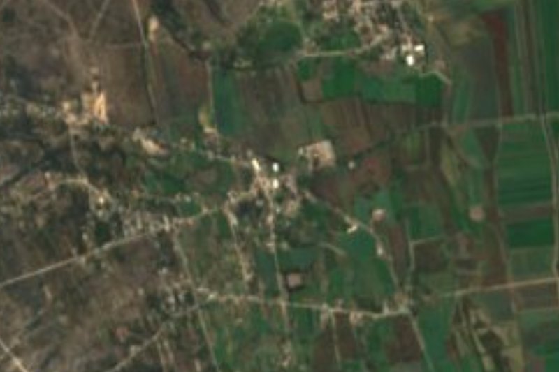
Tianguistengo comes from Nahuatl and, according to PueblosAmérica, points to a spot "at the edge" of the tianguis, the market. The village, with 663 residents in 2020 (716 in 2010), sits at 2,370 metres on rolling hill country about 10 kilometres east of Actopan, and its water runs down to the Amajac river sub-basin. The climate is temperate and sub-humid, with summer rains and an annual mean around 13.6 °C; January is the coldest month and May the warmest.
The parish church of San Andrés is the village's church and has its own category on Wikimedia Commons. In 2020, 22% of the population identified as Indigenous and 8% spoke an Indigenous language; INEGI counts 168 occupied homes, almost all with electricity, and a high marginalisation rating.
Hills crowd in close: Cerro Corona (2,573 m) 1.4 km west, Cerro Grande (2,623 m) and Peña Larga (2,496 m) to the northwest, and El Alto, at 2,901 m, about 3 km south. Neighbouring communities include Fray Francisco (2.2 km northeast), Santa María Magdalena (3.3 km west) and San Jerónimo (3.8 km east). In Actopan, some 10 km away, stands the sixteenth-century Augustinian convent, already finished by the 1570s.
How to get to San Andrés Tianguistengo
Drive from Pachuca: 50 min, 46 km
San Andrés Tianguistengo lies about 10 km east of Actopan (9.9 km in a straight line per PueblosAmérica, 10.7 km per Wikipedia). Actopan is 37 km from Pachuca and roughly 120-125 km from Mexico City, on federal highway 85 (México-Laredo), and has the Terminal de Autotransportes de Actopan (TAAC), with departures to Mexico City, Pachuca, Ixmiquilpan, Zimapán, Tulancingo and Tula. The village has no lodging: the nearest hotels (Liveng, Real Jade, Posada Mirador) are about 11 to 14 km to the west and southwest. Mineral del Chico is some 21 to 24 km by road.
Directions to San Andrés Tianguistengo on Google Maps
Distances are in a straight line; the road is usually longer.
Links open a partner site. We may earn a commission if you book, at no cost to you.
From the nearest cities to San Andrés Tianguistengo
- Pachuca · 46 km by road, 50 min
- Tulancingo · 92 km by road, 1 h 35 min
- Mexico City · 129 km by road, 2 h
Drive times by road from OpenStreetMap, without traffic or stops. Times marked ~ are estimated from the straight-line distance.
Visiting San Andrés Tianguistengo: what to see and do
Parish church of San Andrés, in the village centre
Cerro Corona (2,573 m), 1.4 km west
El Alto (2,901 m), about 3 km south
Fray Francisco and Santa María Magdalena, neighbouring communities
Augustinian convent of Actopan, some 10 km away
Plan your trip
Places to stay in San Andrés Tianguistengo
Compare hotels, posadas, and rentals in and around San Andrés Tianguistengo.
Tours & activities
Day trips and guided outings from Mineral del Chico often include San Andrés Tianguistengo; with a local guide you can get there without a car.
Rental cars
Pick up a car at NLU (Mexico City (Felipe Ángeles)): about 1 h 12 min by road to Mineral del Chico, then 13 km more to San Andrés Tianguistengo, on your own schedule.
Flights
The nearest airport with scheduled flights is Mexico City (Felipe Ángeles) (NLU), about 1 h 12 min by road from Mineral del Chico, the base for San Andrés Tianguistengo.
Mobile data
Signal can drop away from Mineral del Chico: download a map of the way to San Andrés Tianguistengo before you set out, or carry an eSIM with data.
Links open a partner site. We may earn a commission if you book, at no cost to you.
When to go to San Andrés Tianguistengo cool
San Andrés Tianguistengo shares the climate of Mineral del Chico, 13 km away. The best months to visit are February, March, April, and May.
See the month-by-month climate of Mineral del Chico
Weather in San Andrés Tianguistengo now and the next 7 days
Live forecast from Open-Meteo. Chance of rain is the day's highest.
The closest Pueblo Mágico: Mineral del Chico

Mineral del Chico is the Pueblo Mágico closest to San Andrés Tianguistengo, with places to stay, food, and more to see.
Also close to
- Real del Monte · Hidalgo · 24 km away
- Huasca de Ocampo · Hidalgo · 28 km away
- Metztitlán · Hidalgo · 36 km away
- Zempoala · Hidalgo · 44 km away
- Teotihuacán · Estado de México · 64 km away
Closest to San Andrés Tianguistengo
-
Presa San Jerónimo · Lake · 4 km away
-
San Jerónimo · Village · 4 km away
-
El Rincón · Village · 6 km away
-
El Arenal · Town · 8 km away
-
La Estancia · Village · 8 km away
-
San José Tepenene · Village · 8 km away
-
Actopan · Town · 10 km away
-
Dajiedhi · Village · 11 km away


Near San Andrés Tianguistengo




Drive times by road from OpenStreetMap, without traffic. Times marked ~ are estimated from the straight-line distance.
Location from OpenStreetMap. Written by Puebloteca.