
Town San Agustín Tlaxiaca, Hidalgo Municipality of San Agustín Tlaxiaca Hidalgo Mountain Corridor Comarca Minera Geopark
Municipal seat in the Mezquital Valley within the Pachuca metro area; at its patron-saint fair the crosses are carried down and up the Cerro de la Providencia.
From Pachuca: 20 min by car (20 km by road) How to get there ↓
Near here
See everything nearby ↓


Plan your visit to San Agustín Tlaxiaca
Where to stay near San Agustín Tlaxiaca
Compare hotels, posadas and guest houses in San Agustín Tlaxiaca.
Tours to San Agustín Tlaxiaca
Day trips around Mineral del Chico sometimes stop in San Agustín Tlaxiaca; a tour is the easy way to see it without a car.
How to get to San Agustín Tlaxiaca
- From Pachuca: about 20 min by road (~20 km)
- Nearest airport: Mexico City (Felipe Ángeles) (NLU), 1 h 12 min by car to Mineral del Chico
Links open a partner site. We may earn a commission if you book, at no cost to you.
About San Agustín Tlaxiaca
Tlaxiaca comes from Nahuatl and means "among the trees of the ball game"; San Agustín was added in honour of the saint of Hippo. Almost nothing is recorded about why the town was founded at this spot in pre-Hispanic times, but remains across the region show that Nahua groups passed and settled here: the Otomí came first, then the Toltecs left their influence on their way to Tula and Tulancingo, and later the Mexica extended their rule over these plains. In colonial times the municipality's main community was Ixcuinquitlapilco, an alcaldía mayor and república de indios answerable to Actopan. San Agustín Tlaxiaca became municipal seat on 16 October 1872.
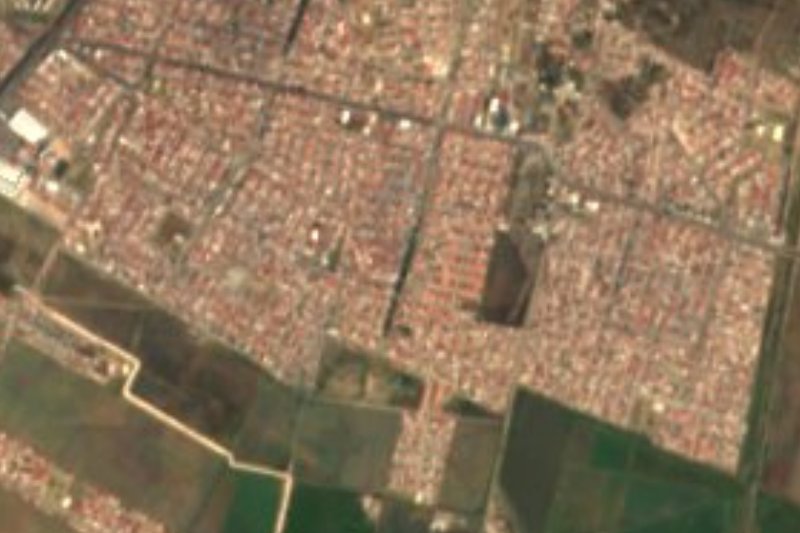
The town lies in the Mezquital Valley at about 2,360 metres, among plains and low hills of the Trans-Mexican Volcanic Belt. The climate is semi-dry and semi-warm, with 570 to 770 mm of rain a year, heaviest in September and October. INEGI counted 12,328 residents in 2020, nearly a third of the municipality's 38,891, which spreads over 297 km² and has 59 localities. Only 88 people speak an Indigenous language. The municipality belongs to the Pachuca metropolitan area.
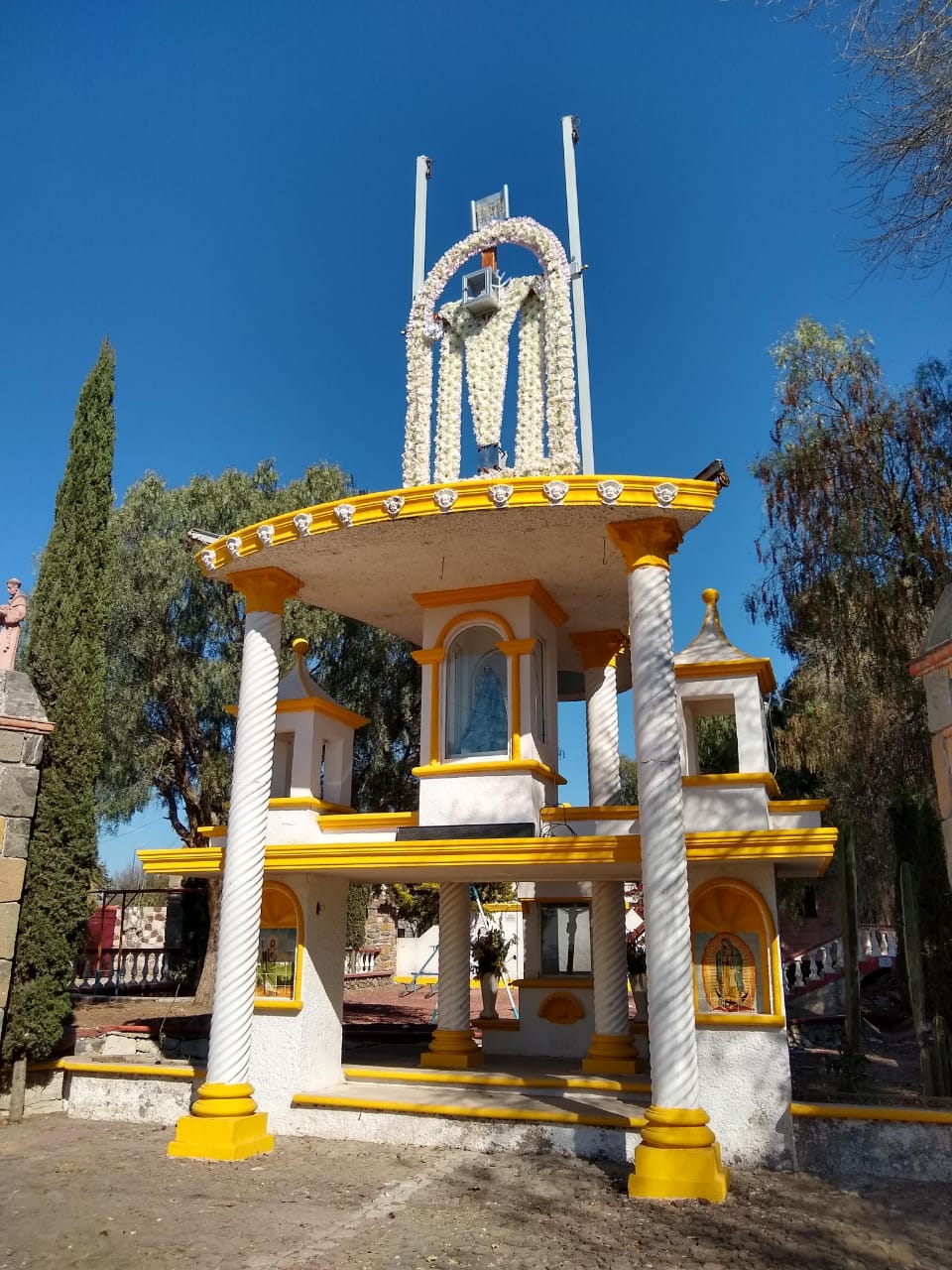
The patron-saint fair for San Agustín has a ritual of its own. The town's four barrios, Mexiquito, Casa Grande, Fresno and Huizache, bring the crosses down from the Cerro de la Providencia (also called Cerro Grande or Cerro de las Cruces) to be decorated and blessed, and when the fair ends they carry them back up. Across the municipality pepper trees dominate, with mesquites, ash trees and huizaches in smaller numbers, and the community has a multi-level chapel.
How to get to San Agustín Tlaxiaca
Drive from Pachuca: 20 min, 20 km
San Agustín Tlaxiaca lies west of Pachuca, inside its metropolitan area, about 15 km in a straight line (approx.) from the state capital's centre. Leaving Pachuca you take the Pachuca-Actopan highway, which passes in front of El Durazno and is the backbone of the trip. Hidalgo's mobility ministry launched route SAT 17 on 1 August 2022, linking Tlaxiaca with Pachuca's Explanada plaza, next to the Chedraui: it leaves the town through Era, the Health Centre, Pemex-Independencia, Tecámatl and La Nopalera, takes the Pachuca-Actopan highway, continues along Boulevard Santa Catarina (General Hospital, Ciudad del Conocimiento, Tlapacoya, the State Congress) and Boulevard Nuevo Hidalgo to Villas de Pachuca. Check the route's frequency and whether it still runs.
Arriving in Pachuca from another city, you get off at the Central Bus Terminal on Boulevard Javier Rojo Gómez: coaches come from Mexico City Norte and TAPO, Querétaro, Actopan and Ixmiquilpan, among others. From there continue by city transport to the Explanada plaza, or by taxi. The town lies about 17 km in a straight line (approx.) from Mineral del Chico, the nearest Pueblo Mágico.
Directions to San Agustín Tlaxiaca on Google Maps
Distances are in a straight line; the road is usually longer.
Links open a partner site. We may earn a commission if you book, at no cost to you.
From the nearest cities to San Agustín Tlaxiaca
- Pachuca · 20 km by road, 20 min
- Tulancingo · 66 km by road, 1 h 5 min
- Mexico City · 102 km by road, 1 h 30 min
Drive times by road from OpenStreetMap, without traffic or stops. Times marked ~ are estimated from the straight-line distance.
Before you go to San Agustín Tlaxiaca: hours, prices and tips
- Best season
- The San Agustín patron-saint fair includes the four barrios bringing the crosses down from, and back up to, the Cerro de la Providencia (the source gives no date). Wikipedia · checked Oct 2026
Hours and prices change, especially around holidays. Each fact links to where we checked it.
Visiting San Agustín Tlaxiaca: what to see and do
The carrying of the crosses down and up the Cerro de la Providencia during the patron-saint fair.
The community's multi-level chapel.
The four barrios: Mexiquito, Casa Grande, Fresno and Huizache.
The pepper trees, mesquites and huizaches of the Mezquital Valley.
Plan your trip
Places to stay in San Agustín Tlaxiaca
Compare hotels, posadas, and rentals in and around San Agustín Tlaxiaca.
Tours & activities
Day trips around Mineral del Chico sometimes stop in San Agustín Tlaxiaca; a tour is the easy way to see it without a car.
Rental cars
Pick up a car at NLU (Mexico City (Felipe Ángeles)): about 1 h 12 min by road to Mineral del Chico, then 17 km more to San Agustín Tlaxiaca, on your own schedule.
Flights
The nearest airport with scheduled flights is Mexico City (Felipe Ángeles) (NLU), about 1 h 12 min by road from Mineral del Chico, the base for San Agustín Tlaxiaca.
Mobile data
Signal can drop away from Mineral del Chico: download a map of the way to San Agustín Tlaxiaca before you set out, or carry an eSIM with data.
Links open a partner site. We may earn a commission if you book, at no cost to you.
When to go to San Agustín Tlaxiaca cool
San Agustín Tlaxiaca shares the climate of Mineral del Chico, 17 km away. The best months to visit are February, March, April, and May.
See the month-by-month climate of Mineral del Chico
Weather in San Agustín Tlaxiaca now and the next 7 days
Live forecast from Open-Meteo. Chance of rain is the day's highest.
The closest Pueblo Mágico: Mineral del Chico

Mineral del Chico is the Pueblo Mágico closest to San Agustín Tlaxiaca, with places to stay, food, and more to see.
Also close to
- Real del Monte · Hidalgo · 23 km away
- Zempoala · Hidalgo · 32 km away
- Huasca de Ocampo · Hidalgo · 32 km away
- Teotihuacán · Estado de México · 47 km away
- Otumba · Estado de México · 49 km away
Closest to San Agustín Tlaxiaca
-
El Durazno · Village · 4 km away
-
Santiago Tlapacoya · Village · 6 km away
-
San José Tepenene · Village · 10 km away
-
Acayuca · Town · 11 km away
-
El Arenal · Town · 12 km away
-
Parque Cultural Hidalguense · Nature reserve · 12 km away
-
Puerto México · Village · 12 km away
-
Cipreses · Village · 14 km away
Near San Agustín Tlaxiaca




Drive times by road from OpenStreetMap, without traffic. Times marked ~ are estimated from the straight-line distance.
Location from OpenStreetMap. Written by Puebloteca.