Village Olintla, Puebla Sierra Norte de Puebla Totonacapan
Totonac-country hamlet of Olintla beside the Ajajalpan river, at 512 m and just 6 km from Zozocolco across the Veracruz line.
From Papantla: 1 h 40 min by car (89 km by road) How to get there ↓
Near here
See everything nearby ↓


Plan your visit to Dimas López
Where to stay near Dimas López
Compare hotels, posadas and guest houses in Dimas López.
Tours to Dimas López
Day trips and guided outings from Zozocolco often include Dimas López; with a local guide you can get there without a car.
How to get to Dimas López
- From Papantla: about 1 h 40 min by road (~89 km)
- Nearest airport: Poza Rica (PAZ), 3 h 15 min by car to Zozocolco
Links open a partner site. We may earn a commission if you book, at no cost to you.
About Dimas López
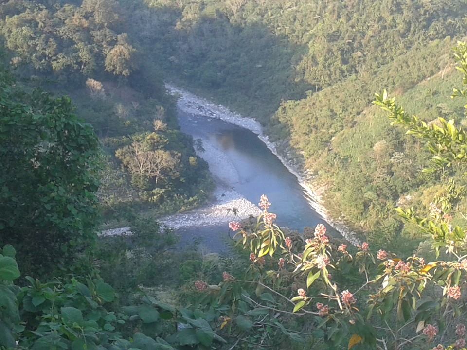
The Ajajalpan river runs past Dimas López, and that stream is what the photo shows: green water between wooded slopes on the northern edge of Puebla's Sierra Norte. The settlement belongs to Olintla, counted 663 residents in the 2020 census and sits at roughly 512 metres, far lower than most mountain towns. It lies so close to the state line that Zozocolco, on the Veracruz side, is about 6 km away and Poza Rica about 45 km, while the city of Puebla is some 138 km off.
Olintla's name is Nahuatl, and Wikipedia gives two readings: "place of earthquakes" or "place where there is rubber". The municipality is small, a little over 66 km², bordering Veracruz, Jopala, Ixtepec and Hermenegildo Galeana to the north and Huehuetla and Caxhuacán to the east. Almost all of it drains into the Laxaxalpan, a tributary of the Tecolutla, inside the large Tuxpan–Nautla hydrological region. Besides the Ajajalpan, INEGI lists the Tapayula, San Pedro and Tecuantepec as year-round rivers, which accounts for how green the country is.
Rain falls in every month here: the municipal compendium records 2,400 to 3,600 mm a year and temperatures of 18 to 24 °C, a humid semi-warm climate. Just over a quarter of the municipality is still tropical forest and nearly a fifth is woodland; the rest is cornfields, coffee and pasture. Totonac and Nahuatl are spoken in the area, and INEGI names woodcarving, cedar furniture, embroidery, pottery and wool weaving as local trades. Food includes chicken tixmole, mole de siembra, tamales and barbacoa, with jamoncillo for dessert; the music at fiestas is huapango.
How to get to Dimas López
Drive from Papantla: 1 h 40 min, 89 km
Dimas López is about 138 km from the city of Puebla, at the far northern end of the sierra. Given its location, the practical reference points are in Veracruz: Zozocolco de Hidalgo some 6 km away and Poza Rica, the nearest large city, about 45 km off. Expect to arrive by car or local transport on mountain roads where rain is frequent.
Directions to Dimas López on Google Maps
Distances are in a straight line; the road is usually longer.
Links open a partner site. We may earn a commission if you book, at no cost to you.
From the nearest cities to Dimas López
- Papantla · 89 km by road, 1 h 40 min
- Poza Rica · 108 km by road, 1 h 55 min
- Teziutlán · 108 km by road, 1 h 55 min
Drive times by road from OpenStreetMap, without traffic or stops. Times marked ~ are estimated from the straight-line distance.
Visiting Dimas López: what to see and do
The Ajajalpan river, flowing beside the houses and pooling among the vegetation. In Olintla town, the church of San José, which INEGI dates to the 16th century, and the municipal hall. Cedar woodwork, embroidery and pottery made in the municipality.
Plan your trip
Places to stay in Dimas López
Compare hotels, posadas, and rentals in and around Dimas López.
Tours & activities
Day trips and guided outings from Zozocolco often include Dimas López; with a local guide you can get there without a car.
Rental cars
Pick up a car at PAZ (Poza Rica): about 3 h 15 min by road to Zozocolco, then 6 km more to Dimas López, on your own schedule.
Flights
The nearest airport with scheduled flights is Poza Rica (PAZ), about 3 h 15 min by road from Zozocolco, the base for Dimas López.
Mobile data
Signal can drop away from Zozocolco: download a map of the way to Dimas López before you set out, or carry an eSIM with data.
Links open a partner site. We may earn a commission if you book, at no cost to you.
When to go to Dimas López warm
Dimas López shares the climate of Zozocolco, 6 km away. The best months to visit are February, March, November, and December.
See the month-by-month climate of Zozocolco
Weather in Dimas López now and the next 7 days
Live forecast from Open-Meteo. Chance of rain is the day's highest.
The closest Pueblo Mágico: Zozocolco

Zozocolco is the Pueblo Mágico closest to Dimas López, with places to stay, food, and more to see.
Also close to
- Cuetzalan · Puebla · 20 km away
- Tlatlauquitepec · Puebla · 37 km away
- Xicotepec · Puebla · 38 km away
- Tetela de Ocampo · Puebla · 42 km away
- Zacatlán · Puebla · 42 km away
Closest to Dimas López
-
Coxquihui · Town · 6 km away
-
Huehuetla · Town · 6 km away
-
Jopala · Village · 6 km away
-
Olintla · Village · 8 km away
-
Cerro Grande · Village · 10 km away
-
Coyutla · Town · 10 km away
-
Caxhuacan · Village · 11 km away
-
Bienvenido · Village · 12 km away

Near Dimas López


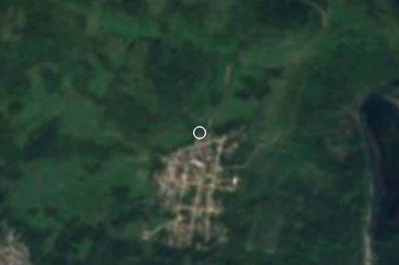


Drive times by road from OpenStreetMap, without traffic. Times marked ~ are estimated from the straight-line distance.
Location from OpenStreetMap. Written by Puebloteca.