Village Jopala, Puebla Municipality of Jopala Sierra Norte de Puebla Totonacapan
Totonac-speaking seat in Puebla's Sierra Norte: the Assumption parish and an 11-day August fair with negritos, quetzales and voladores.
From Huauchinango: 1 h 25 min by car (67 km by road) How to get there ↓
Near here
See everything nearby ↓



Plan your visit to Jopala
Where to stay near Jopala
Compare hotels, posadas and guest houses in Jopala.
Tours to Jopala
Day trips and guided outings from Zozocolco often include Jopala; with a local guide you can get there without a car.
How to get to Jopala
- From Huauchinango: about 1 h 25 min by road (~67 km)
- Nearest airport: Poza Rica (PAZ), 3 h 15 min by car to Zozocolco
Links open a partner site. We may earn a commission if you book, at no cost to you.
About Jopala
Jopala is the seat of a coffee-growing municipality on the slope where Puebla's Sierra Norte falls toward the Gulf coast, in the Tecolutla river basin right on the Veracruz border. Totonac (Tutunakú) is spoken here alongside Spanish. The name comes from the Nahuatl xopalli, "green", and is usually translated as "place of much green". The town had 1,479 residents in 2020, in the neighbourhoods of Centro, Bugambilias, Patángo, Sataskahuatl and Ixkimpan.
Nahua and Totonac people lived here before the Spanish, who subdued the area in 1522. In the late 19th century Jopala was part of the Zacatlán district, and it became a free municipality in 1895. The climate is warm and humid all year, and coffee groves and pasture have replaced nearly all the original forest.
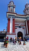
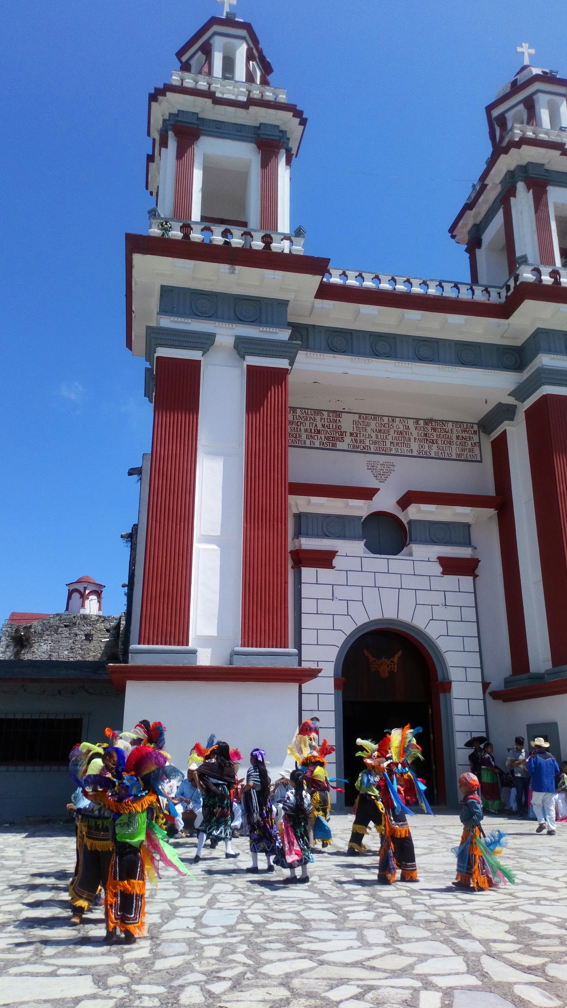
The reason to come is the fair of the Virgin of the Assumption, which runs from 12 to 22 August with its main day on the 15th. In the atrium of the parish church, a white and red facade with two towers, groups dance the negritos, toreadores, malinches, San Miguel, huehues, españoles, quetzales and voladores, with processions and firework towers paid for by the stewards. About 3 km from the centre the Ajajalpan river has spots for swimming and fishing, and the Necaxa runs about 10 km away.
How to get to Jopala
Drive from Huauchinango: 1 h 25 min, 67 km
Jopala is easiest to reach from the Veracruz side. From Poza Rica it is about 74 km and 1 h 30 min: federal highway 130 toward Entabladero, then state road VER-127 on the Coyutla branch and a final mountain stretch to Jopala. Zozocolco, a Veracruz Pueblo Mágico, is roughly 45 km (almost an hour) away, again through Coyutla. From Huauchinango it is about 67 km and 1 h 20 min on federal 130 and state road PUE-105. The state capital is some 220 km away, around 3 h 30 min via Apizaco and the motorway to Nuevo Necaxa. Bus times are not published; ask in Coyutla or Huauchinango.
Directions to Jopala on Google Maps
Distances are in a straight line; the road is usually longer.
Links open a partner site. We may earn a commission if you book, at no cost to you.
From the nearest cities to Jopala
- Huauchinango · 67 km by road, 1 h 25 min
- Poza Rica · 73 km by road, 1 h 30 min
- Papantla · 80 km by road, 1 h 30 min
Drive times by road from OpenStreetMap, without traffic or stops. Times marked ~ are estimated from the straight-line distance.
Before you go to Jopala: hours, prices and tips
- Best season
- Fair of the Virgin of the Assumption from 12 to 22 August; main day the 15th. Wikipedia, Municipio de Jopala · checked Oct 2026
Hours and prices change, especially around holidays. Each fact links to where we checked it.
Visiting Jopala: what to see and do
The parish church of the Virgin of the Assumption and its atrium, where the dances are held.
The patron saint fair from 12 to 22 August, peaking on the 15th.
Negritos, toreadores, malinches, huehues, quetzales and voladores dances.
The Ajajalpan river, about 3 km from town, for swimming and fishing.
The Necaxa river, about 10 km away.
Hillside coffee groves and mountain food: mole, pipián, tamales and coffee.
Plan your trip
Places to stay in Jopala
Compare hotels, posadas, and rentals in and around Jopala.
Tours & activities
Day trips and guided outings from Zozocolco often include Jopala; with a local guide you can get there without a car.
Rental cars
Pick up a car at PAZ (Poza Rica): about 3 h 15 min by road to Zozocolco, then 11 km more to Jopala, on your own schedule.
Flights
The nearest airport with scheduled flights is Poza Rica (PAZ), about 3 h 15 min by road from Zozocolco, the base for Jopala.
Mobile data
Signal can drop away from Zozocolco: download a map of the way to Jopala before you set out, or carry an eSIM with data.
Links open a partner site. We may earn a commission if you book, at no cost to you.
When to go to Jopala warm
Jopala shares the climate of Zozocolco, 11 km away. The best months to visit are February, March, November, and December.
See the month-by-month climate of Zozocolco
Weather in Jopala now and the next 7 days
Live forecast from Open-Meteo. Chance of rain is the day's highest.
The closest Pueblo Mágico: Zozocolco

Zozocolco is the Pueblo Mágico closest to Jopala, with places to stay, food, and more to see.
Also close to
- Cuetzalan · Puebla · 24 km away
- Xicotepec · Puebla · 32 km away
- Huauchinango · Puebla · 38 km away
- Zacatlán · Puebla · 38 km away
- Tlatlauquitepec · Puebla · 40 km away
Closest to Jopala
-
Buenos Aires · Village · 6 km away
-
Dimas López · Village · 6 km away
-
Bienvenido · Village · 7 km away
-
Olintla · Village · 7 km away
-
Cerro Grande · Village · 8 km away
-
Coyutla · Town · 10 km away
-
Huehuetla · Town · 10 km away
-
Coxquihui · Town · 11 km away


Near Jopala






Drive times by road from OpenStreetMap, without traffic. Times marked ~ are estimated from the straight-line distance.
Location from OpenStreetMap. Written by Puebloteca.