

Town Villa de Tezontepec, Hidalgo
Seat of Villa de Tezontepec: a 16th-century Augustinian friary, weekend pit barbacoa and the giant tortas of Torta Makers' Day.
From Pachuca: 35 min by car (35 km by road) How to get there ↓
Near here
See everything nearby ↓



Plan your visit to Tezontepec
Where to stay near Tezontepec
Compare hotels, posadas and guest houses in Tezontepec.
Tours to Tezontepec
Day trips around Zempoala sometimes stop in Tezontepec; a tour is the easy way to see it without a car.
How to get to Tezontepec
- From Pachuca: about 35 min by road (~35 km)
- Nearest airport: Mexico City (Felipe Ángeles) (NLU), 58 min by car to Zempoala
Links open a partner site. We may earn a commission if you book, at no cost to you.
About Tezontepec
Tezontepec means "on the hill of tezontle", and the town was indeed founded on top of a hill of that reddish volcanic stone, at 2,321 metres in the Tizayuca valley. Around 1530 it was home to a mix of Nahua, Chichimec and Otomí people under the lordship of Tizayuca, itself a tributary of Texcoco; its first encomendero was Baltazar de Obregón. Augustinian friars built the church of San Pedro in 1540 and the friary in 1554, and fresco paintings survive in the cloister. In colonial times it belonged to Pachuca; it became a municipality in 1869, and on 13 November 1912 the congress raised it to the rank of villa, hence the municipality's name. The town itself has 6,213 residents.
The upper cloister of the former friary houses the Museo Prehispánico y Religioso Fe y Cultura, with clay and stone figurines, religious objects from several periods and mammoth bones found in the Barrancas de Acozac, about 10 km from the centre. The main square has an octagonal bandstand in an oriental style, ringed with dragons. On another hill, propped on tall pillars, stands the Santuario de Tlexpa, built in 1945 for the Virgin of San Juan de los Lagos, known locally as the Virgen del Cerrito. The old railway station and parts of the centre were used as a location for the TV series Club de Cuervos.
Most visitors, though, come to eat. At weekends barbacoa stalls set up in the central garden, selling meat slow-cooked in an earth pit with maguey leaves and tezontle stones; arrive early and you can watch the oven being opened. Giant tortas have been made here since 1958, and on 1 May, Torta Makers' Day, thousands are handed out free. Pulque is the drink and handmade ice cream the dessert. The Monday market is said to be the oldest in the region, and the craft corridor and shops in the centre sell western wear, boots and leather goods.
How to get to Tezontepec
Drive from Pachuca: 35 min, 35 km
From Mexico City take the México–Pachuca highway and, past Tizayuca, the turn-off for Villa de Tezontepec; it is about 65 km and 1 hour to 1 h 30 min depending on traffic. From Pachuca it is roughly 33 km by road, around 35 minutes by car.
Public transport is thin and there is no well-established direct bus from the main terminals, so the practical options are driving or a taxi from Pachuca (about 35 minutes) or Tizayuca. Zempoala, the nearest Pueblo Mágico, is about 16 km away in a straight line.
Directions to Tezontepec on Google Maps
Distances are in a straight line; the road is usually longer.
Links open a partner site. We may earn a commission if you book, at no cost to you.
From the nearest cities to Tezontepec
- Pachuca · 35 km by road, 35 min
- Tulancingo · 62 km by road, 55 min
- Mexico City · 70 km by road, 1 h 5 min
Drive times by road from OpenStreetMap, without traffic or stops. Times marked ~ are estimated from the straight-line distance.
Before you go to Tezontepec: hours, prices and tips
- Best time of day
- A weekend morning, when the barbacoa stalls set up in the central garden; Monday is market day. Criterio Hidalgo; México Desconocido · checked Oct 2026
- Best season
- Holy Week; Torta Makers' Day on 1 May; the Virgin of San Juan de los Lagos on 24 June; San Pedro Apóstol, the patron feast, on 29 June; Precious Blood on 14 September; Independence festivities on 15-16 September; 12 December. México Desconocido: Villa de Tezontepec · checked Oct 2026
Hours and prices change, especially around holidays. Each fact links to where we checked it.
Visiting Tezontepec: what to see and do
The Augustinian church and former friary of San Pedro Apóstol, with frescoes
Museo Prehispánico y Religioso Fe y Cultura in the upper cloister
The octagonal dragon bandstand on the main square
Santuario de Tlexpa on its hilltop, dedicated to the Virgen del Cerrito
The old railway station
Weekend pit barbacoa in the central garden, and giant tortas
Barrancas de Acozac, about 10 km away, where mammoth remains were found
Plan your trip
Places to stay in Tezontepec
Compare hotels, posadas, and rentals in and around Tezontepec.
Tours & activities
Day trips around Zempoala sometimes stop in Tezontepec; a tour is the easy way to see it without a car.
Rental cars
Pick up a car at NLU (Mexico City (Felipe Ángeles)): about 58 min by road to Zempoala, then 16 km more to Tezontepec, on your own schedule.
Flights
The nearest airport with scheduled flights is Mexico City (Felipe Ángeles) (NLU), about 58 min by road from Zempoala, the base for Tezontepec.
Mobile data
Signal can drop away from Zempoala: download a map of the way to Tezontepec before you set out, or carry an eSIM with data.
Links open a partner site. We may earn a commission if you book, at no cost to you.
When to go to Tezontepec cool
Tezontepec shares the climate of Zempoala, 16 km away. The best months to visit are January, February, November, and December.
See the month-by-month climate of Zempoala
Weather in Tezontepec now and the next 7 days
Live forecast from Open-Meteo. Chance of rain is the day's highest.
The closest Pueblo Mágico: Zempoala

Zempoala is the Pueblo Mágico closest to Tezontepec, with places to stay, food, and more to see.
Also close to
- Otumba · Estado de México · 21 km away
- Teotihuacán · Estado de México · 21 km away
- Real del Monte · Hidalgo · 33 km away
- Mineral del Chico · Hidalgo · 37 km away
- Huasca de Ocampo · Hidalgo · 43 km away
Closest to Tezontepec
-
Morelos · Village · 2 km away
-
Ixtlahuaca de Cuauhtémoc · Village · 4 km away
-
Temascalapa · Town · 10 km away
-
Zapotlán de Juárez · Village · 11 km away
-
Don Antonio · Town · 12 km away
-
San Pedro Huaquilpan · Town · 13 km away
-
Tolcayuca · Town · 14 km away
-
San Felipe Teotitlán · Village · 15 km away

Near Tezontepec


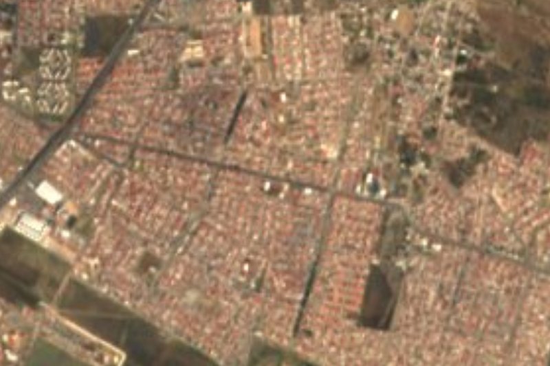


Drive times by road from OpenStreetMap, without traffic. Times marked ~ are estimated from the straight-line distance.
Location from OpenStreetMap. Written by Puebloteca.