Town Tetecala, Morelos Southern Morelos
Western Morelos municipal seat by the Chalma River: San Francisco church, old mansions, a Tuesday market and October fiestas.
From Cuernavaca: 45 min by car (44 km by road) How to get there ↓
Near here



Plan your visit to Tetecala
Where to stay near Tetecala
Compare hotels, posadas and guest houses in Tetecala.
Tours to Tetecala
Day trips around Xochitepec sometimes stop in Tetecala; a tour is the easy way to see it without a car.
 Tours from Cuernavaca
3hr Cooking Class in Cuernavaca 8 Recipes and Bottomless Drinks
From US$59
How to get to Tetecala
- From Cuernavaca: about 45 min by road (~44 km)
- Nearest airport: Toluca (TLC), 1 h 59 min by car to Xochitepec
Links open a partner site. We may earn a commission if you book, at no cost to you.
Tours from Cuernavaca, near Tetecala


Tours, prices and ratings from Viator, checked weekly. We may earn a commission if you book.
About Tetecala
Tetecala means "place of stone houses" in Nahuatl and first shows up on a map between 1521 and 1583; by 1594 it was San Francisco de Tetecala, an important farming centre. In 1826 it had fewer people than Xochitepec, Tlaltizapán or Puente de Ixtla but more trade than any of them: sugar cane, bananas, jicama, plums, watermelon and mamey were grown here. Fruit trees and plenty of shade still line the Chalma River.
The town played a part in the Reform: in 1857 it sheltered Benito Juárez, the Lerdo de Tejada brothers, Ignacio Manuel Altamirano, El Nigromante and Guillermo Prieto, among others, and in 1873 it took the name Tetecala de la Reforma. In the Revolution the owners of the area's haciendas fled and several peasant groups joined the Zapatistas. The sugar and rice mills were dismantled in the late 1950s and early 1960s; when federal police killed Rubén Jaramillo and his family in 1962, his body was taken to the Tetecala hospital, now the Casa de Cultura.
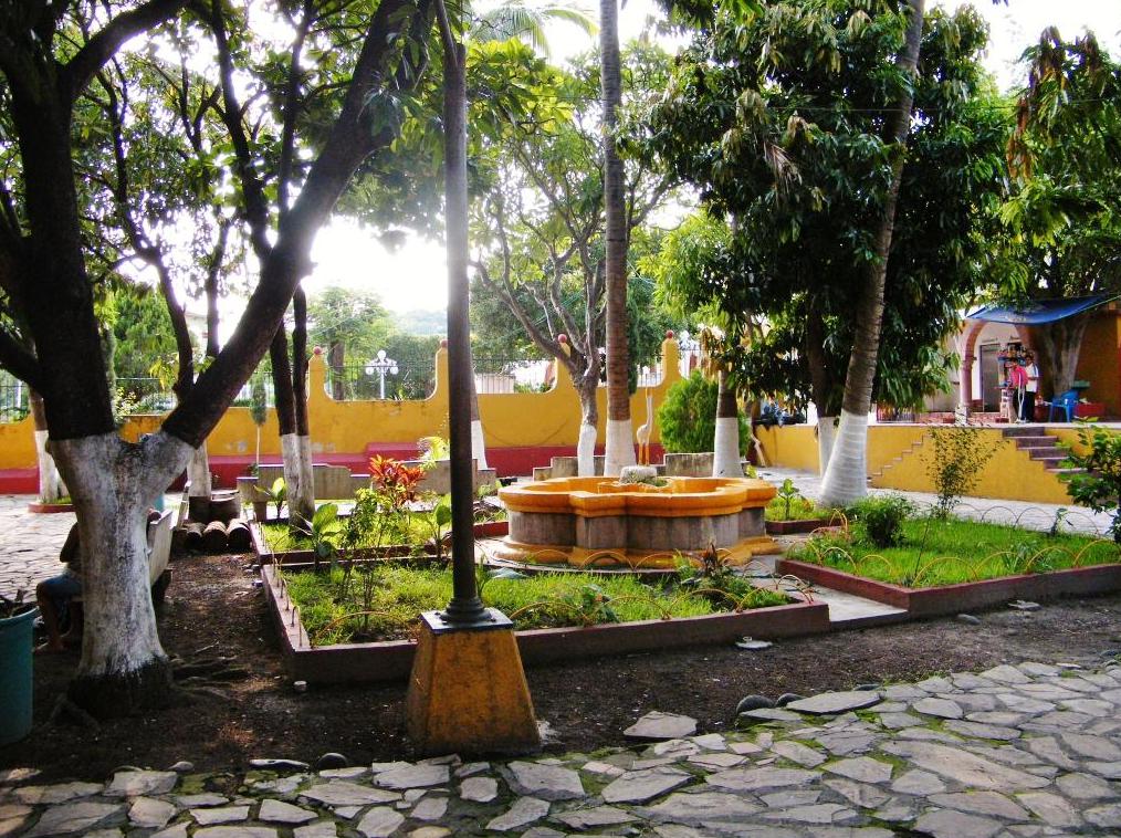
In the centre stands the church of San Francisco de Asís, an 18th-century neoclassical building. On the highway is a chapel of the Virgen de la Candelaria, also 18th century, and a colonial fountain survives in front of another chapel. Some old mansions now house the Casa de Cultura and the regional library. From the Cerro de Las Cruces you can see the whole town, and the manor houses of the Santa Cruz Vista Alegre, Actopan, Cuautlita and Cocoyotla haciendas stand nearby. Market day is Tuesday; saddle-making and basket weaving are local crafts, and the kitchen turns out pozole, green pumpkin-seed mole, clemole with plum and tamarind, and huazontles. The town had 4,781 residents in 2020.
How to get to Tetecala
Drive from Cuernavaca: 45 min, 44 km
From Cuernavaca it is about 42-47 km and around 45 minutes. Take toll motorway 95D toward Acapulco to the Alpuyeca area, continue on federal highway 95 and join federal highway 166 (Alpuyeca–Grutas de Cacahuamilpa), which passes Miacatlán and Mazatepec and reaches Tetecala; the last stretch is along Avenida Benito Juárez. From Xochitepec, the nearest village this guide covers, it is about 26 km and 33 minutes by the same route.
By bus, Pullman de Morelos runs services to Tetecala from the Taxqueña terminal in Mexico City (about 135 km). We found no published timetables for other lines or for combis along the 166, so confirm at the terminal.
Directions to Tetecala on Google Maps
Distances are in a straight line; the road is usually longer.
Links open a partner site. We may earn a commission if you book, at no cost to you.
From the nearest cities to Tetecala
- Cuernavaca · 44 km by road, 45 min
- Taxco · 51 km by road, 1 h
- Iguala · 80 km by road, 1 h 15 min
Drive times by road from OpenStreetMap, without traffic or stops. Times marked ~ are estimated from the straight-line distance.
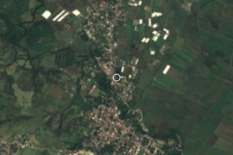
Map of Tetecala
Neighbourhoods and villages of Tetecala
Part of Tetecala or just outside it, closest first.
-
Coatlán del Río · Village · 4 km from the centre
Municipal seat in western Morelos at 1,020 m, with a mango fair in April, the ruins of Coatlán Viejo and a carved stone in the plaza. -
El Florido · Village · 4 km from the centre
Colony on the edge of Mazatepec at 989 m, 1,191 residents in 2020, on the Alpuyeca-Grutas road. -
Mazatepec · Town · 4 km from the centre
A small town known for its hilltop sanctuary of the Señor del Calvario and its big Fifth Friday of Lent fair.
Day trips and tours from Tetecala
The closest Pueblos Mágicos and places to visit, with the drive from Tetecala and tours that leave from it.




Times marked ~ are estimated from the distance. Links open a partner site. We may earn a commission if you book, at no cost to you.
Before you go: getting to and around Tetecala
- The nearest airport is Toluca (TLC).
- The best months to go are January, February, November, and December.
- 3 of the places on this page are more than 3 km from the centre: take a taxi, a ride-hailing app or a local bus.
- For day trips a rental car gives the most freedom; the tours above leave from Tetecala.
Before you go to Tetecala: hours, prices and tips
- Best time of day
- The traditional tianguis is on Tuesdays. Fiestas fall on 2 February (Candlemas), 4 October (San Francisco de Asís) and 12 December (Guadalupe, in the El Paso neighborhood). Wikipedia (en): Tetecala · checked Oct 2026
Hours and prices change, especially around holidays. Each fact links to where we checked it.
Visiting Tetecala: what to see and do
Church of San Francisco de Asís, neoclassical, in the historic centre
Chapel of the Virgen de la Candelaria on the highway, and the colonial fountain in front of another chapel
Casa de Cultura and regional library, in old mansions
Viewpoint on the Cerro de Las Cruces
The Chalma River and its fruit-tree bottomland
The Tuesday tianguis
Plan your trip
Places to stay in Tetecala
Compare hotels, posadas, and rentals in and around Tetecala.
Tours & activities
Day trips around Xochitepec sometimes stop in Tetecala; a tour is the easy way to see it without a car.
Rental cars
Pick up a car at TLC (Toluca): about 1 h 59 min by road to Xochitepec, then 12 km more to Tetecala, on your own schedule.
Flights
The nearest airport with scheduled flights is Toluca (TLC), about 1 h 59 min by road from Xochitepec, the base for Tetecala.
Mobile data
Signal can drop away from Xochitepec: download a map of the way to Tetecala before you set out, or carry an eSIM with data.
Links open a partner site. We may earn a commission if you book, at no cost to you.
When to go to Tetecala warm
Tetecala shares the climate of Xochitepec, 12 km away. The best months to visit are January, February, November, and December.
See the month-by-month climate of Xochitepec
Weather in Tetecala now and the next 7 days
Live forecast from Open-Meteo. Chance of rain is the day's highest.
The closest Pueblo Mágico: Xochitepec

Xochitepec is the Pueblo Mágico closest to Tetecala, with places to stay, food, and more to see.
Also close to
- Tlaltizapán · Morelos · 27 km away
- Malinalco · Estado de México · 27 km away
- Taxco · Guerrero · 29 km away
- Tonatico · Estado de México · 30 km away
- Ixtapan de la Sal · Estado de México · 32 km away
Near Tetecala


Drive times by road from OpenStreetMap, without traffic. Times marked ~ are estimated from the straight-line distance.
Location from OpenStreetMap. Written by Puebloteca.