Village Pisaflores, Hidalgo Huasteca Potosina
Village of 776 people at 658 m in the Hidalgo Huasteca, Pisaflores municipality, near the San Luis Potosí border.
From Ciudad Valles: 2 h 20 min by car (122 km by road) How to get there ↓
Near here
See everything nearby ↓


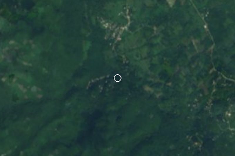
Plan your visit to Gargantilla
Where to stay near Gargantilla
Compare hotels, posadas and guest houses in Gargantilla.
Tours to Gargantilla
Day trips and guided outings from Xilitla often include Gargantilla; with a local guide you can get there without a car.
 Tours from Xilitla
Surrealist Garden of Edward James, Castle of Health and Xilitla Nativity
★ 4.3 (10) · From US$100
How to get to Gargantilla
- From Ciudad Valles: about 2 h 20 min by road (~122 km)
- Nearest airport: Querétaro (QRO), 3 h 27 min by car to Xilitla
Links open a partner site. We may earn a commission if you book, at no cost to you.
Tours from Xilitla, near Gargantilla


Tours, prices and ratings from Viator, checked weekly. We may earn a commission if you book.
About Gargantilla
Gargantilla is in the Hidalgo Huasteca, at 658 metres, in Pisaflores municipality. Here the Sierra Madre Oriental drops in limestone folds (the Carso Huasteco) and the climate is semi-warm and sub-humid with summer rain, in its wetter variant. Local water belongs to the Moctezuma River basin.
In 2020 it had 776 residents, 4.15% of the municipality, and the count grew from the first figure in 1940, when it was 283: 422 in 1980, 707 in 2000 and a peak of 827 in 2010. The whole municipality has 76 localities and a high marginalisation index, and nearly half of its workers farm.
The municipality's name, Pisaflores, comes from the palo de rosa tree: in spring its flowers pile up on the ground. The slopes around grow papaya, mandarin, tamarind, mango, avocado, sapodilla, lime and guava, plus maize, beans, tobacco, chickpea and broad bean, and the woods hold red cedar, palo de rosa, ceiba and oak.
Gargantilla lies close to the state line: Pisaflores borders Xilitla, Matlapa and Tamazunchale, in San Luis Potosí, and Chapulhuacán and La Misión, in Hidalgo, and Landa de Matamoros, in Querétaro, to the west.
How to get to Gargantilla
Drive from Ciudad Valles: 2 h 20 min, 122 km
Gargantilla is in Pisaflores municipality, in northern Hidalgo. There is no direct bus from Pachuca to Pisaflores: the fastest combination listed is the Pachuca-Jacala bus (AVM, sold as Ovnibus) and then a taxi from Jacala to Pisaflores, about 5 hours in all; there are also Actopan-Chapulhuacán buses every 4 hours, taking about 5 h 20 min. By road, Pachuca to Pisaflores is about 255 km (158 miles) and nearly 4 hours. In a straight line Xilitla is about 14 km away (approx. 15 minutes) and Ciudad Valles about 81 km (approx. 95 minutes).
Directions to Gargantilla on Google Maps
Distances are in a straight line; the road is usually longer.
Links open a partner site. We may earn a commission if you book, at no cost to you.
From the nearest cities to Gargantilla
- Ciudad Valles · 122 km by road, 2 h 20 min
- San Juan del Río · about 185 km by road, ~2 h 45 min
- Tulancingo · about 190 km by road, ~2 h 45 min
Drive times by road from OpenStreetMap, without traffic or stops. Times marked ~ are estimated from the straight-line distance.
Visiting Gargantilla: what to see and do
Huasteca slopes planted with papaya, mandarin, mango and avocado
The palo de rosa, a tree whose flowers fall in spring and which names the municipality
Xilitla, about 14 km away in a straight line, across the line in San Luis Potosí
Pisaflores, the municipal seat
Plan your trip
Places to stay in Gargantilla
Compare hotels, posadas, and rentals in and around Gargantilla.
Tours & activities
Day trips and guided outings from Xilitla often include Gargantilla; with a local guide you can get there without a car.
Rental cars
Pick up a car at QRO (Querétaro): about 3 h 27 min by road to Xilitla, then 14 km more to Gargantilla, on your own schedule.
Flights
The nearest airport with scheduled flights is Querétaro (QRO), about 3 h 27 min by road from Xilitla, the base for Gargantilla.
Mobile data
Signal can drop away from Xilitla: download a map of the way to Gargantilla before you set out, or carry an eSIM with data.
Links open a partner site. We may earn a commission if you book, at no cost to you.
When to go to Gargantilla mild
Gargantilla shares the climate of Xilitla, 14 km away. The best months to visit are February, March, August, and November.
See the month-by-month climate of Xilitla
Weather in Gargantilla now and the next 7 days
Live forecast from Open-Meteo. Chance of rain is the day's highest.
The closest Pueblo Mágico: Xilitla

Xilitla is the Pueblo Mágico closest to Gargantilla, with places to stay, food, and more to see.
Also close to
- Aquismón · San Luis Potosí · 40 km away
- Jalpan · Querétaro · 54 km away
- Pinal de Amoles · Querétaro · 71 km away
- Zimapán · Hidalgo · 73 km away
- San Joaquín · Querétaro · 74 km away
Closest to Gargantilla
-
Chapulhuacán · Village · 14 km away
-
Las Pozas · Landmark · 15 km away
-
Neblinas · Village · 17 km away
-
Tamazunchale · Town · 17 km away
-
Castillo de la Salud · Landmark · 20 km away
-
Nacimiento de Huichihuayán · Nature reserve · 22 km away
-
La Silleta · Mountain · 23 km away
-
Misión de Tilaco · Landmark · 27 km away

Near Gargantilla





Drive times by road from OpenStreetMap, without traffic. Times marked ~ are estimated from the straight-line distance.
Location from OpenStreetMap. Written by Puebloteca.