Village Puente de Ixtla, Morelos Municipality of Puente de Ixtla Southern Morelos
Puente de Ixtla village with its own exit on highway 95, 32 km from Cuernavaca; its name refers to little ahuehuete trees.
From Cuernavaca: 35 min by car (34 km by road) How to get there ↓
Near here
See everything nearby ↓


Plan your visit to Ahuehuetzingo
Where to stay near Ahuehuetzingo
Compare hotels, posadas and guest houses in Ahuehuetzingo.
Tours to Ahuehuetzingo
Day trips and guided outings from Xochitepec often include Ahuehuetzingo; with a local guide you can get there without a car.
 Tours from Cuernavaca
3hr Cooking Class in Cuernavaca 8 Recipes and Bottomless Drinks
From US$59
How to get to Ahuehuetzingo
- From Cuernavaca: about 35 min by road (~34 km)
- Nearest airport: Toluca (TLC), 1 h 59 min by car to Xochitepec
Links open a partner site. We may earn a commission if you book, at no cost to you.
Tours from Cuernavaca, near Ahuehuetzingo


Tours, prices and ratings from Viator, checked weekly. We may earn a commission if you book.
About Ahuehuetzingo
The name breaks down into ahuehuetl (ahuehuete, the Montezuma cypress), tzin (a diminutive) and -co (place): "place of the little ahuehuetes". It should not be confused with another Ahuehuetzingo in the municipality of Chietla, Puebla. This one lies at about 975 metres in the municipality of Puente de Ixtla, and one of the municipality's seasonal ravines carries its name.
The censuses tell a story of ups and downs. In 1900 it had 478 residents and in 1910 reached 551, but the 1921 census found only 178; from there it began to recover: 409 in 1950, 745 in 1980, 1,000 in 1990 and 1,675 in 2020.
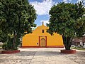
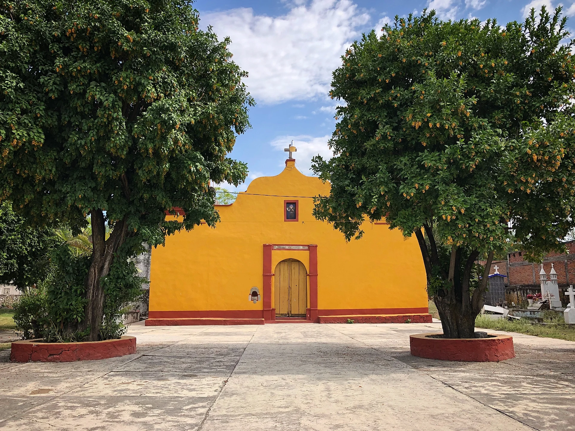
The place sits right on federal highway 95 and has its own junction: the road guide puts it 4 km past the Mazatepec turn-off and 7 km before the junction for Puente de Ixtla. Wikimedia Commons has photographs of its church. Around it, as across the rest of the municipality, tropical dry forest dominates, with ceiba, casahuate, tabachín and bougainvillea.
How to get to Ahuehuetzingo
Drive from Cuernavaca: 35 min, 34 km
From Cuernavaca it is about 32 km and 31 minutes via toll motorway 95D toward Acapulco; pass Alpuyeca, continue on federal highway 95 and take the Ahuehuetzingo exit, which lies 4 km past the Mazatepec turn-off. You enter the village by Calle Iturbide and continue along Hidalgo and Niños Héroes. From Puente de Ixtla it is about 11 km (13 min) on the same federal 95.
By bus, Pullman de Morelos leaves the Taxqueña terminal with stops at Alpuyeca and Crucero Puente de Ixtla; from there you need a taxi or local transport, as we found no published line or timetable that reaches Ahuehuetzingo. On an intercity bus, ask the driver whether he can drop you at the village junction.
Directions to Ahuehuetzingo on Google Maps
Distances are in a straight line; the road is usually longer.
Links open a partner site. We may earn a commission if you book, at no cost to you.
From the nearest cities to Ahuehuetzingo
- Cuernavaca · 34 km by road, 35 min
- Taxco · 53 km by road, 55 min
- Iguala · 72 km by road, 1 h 5 min
Drive times by road from OpenStreetMap, without traffic or stops. Times marked ~ are estimated from the straight-line distance.
Visiting Ahuehuetzingo: what to see and do
The village church, in the centre
Barranca de Ahuehuetzingo, one of the municipality's seasonal streams
Tropical dry forest with ceiba, casahuate and tabachín trees around the village
Plan your trip
Places to stay in Ahuehuetzingo
Compare hotels, posadas, and rentals in and around Ahuehuetzingo.
Tours & activities
Day trips and guided outings from Xochitepec often include Ahuehuetzingo; with a local guide you can get there without a car.
Rental cars
Pick up a car at TLC (Toluca): about 1 h 59 min by road to Xochitepec, then 13 km more to Ahuehuetzingo, on your own schedule.
Flights
The nearest airport with scheduled flights is Toluca (TLC), about 1 h 59 min by road from Xochitepec, the base for Ahuehuetzingo.
Mobile data
Signal can drop away from Xochitepec: download a map of the way to Ahuehuetzingo before you set out, or carry an eSIM with data.
Links open a partner site. We may earn a commission if you book, at no cost to you.
When to go to Ahuehuetzingo warm
Ahuehuetzingo shares the climate of Xochitepec, 13 km away. The best months to visit are January, February, November, and December.
See the month-by-month climate of Xochitepec
Weather in Ahuehuetzingo now and the next 7 days
Live forecast from Open-Meteo. Chance of rain is the day's highest.
The closest Pueblo Mágico: Xochitepec

Xochitepec is the Pueblo Mágico closest to Ahuehuetzingo, with places to stay, food, and more to see.
Also close to
- Tlaltizapán · Morelos · 18 km away
- Taxco · Guerrero · 34 km away
- Malinalco · Estado de México · 36 km away
- Tepoztlán · Morelos · 40 km away
- Tonatico · Estado de México · 40 km away
Closest to Ahuehuetzingo
-
Hacienda San José Vista Hermosa · Landmark · 5 km away
-
Paracaidismo en Tequesquitengo · Landmark · 6 km away
-
Zona Arqueológica de Coatetelco · Archaeological site · 6 km away
-
Cuauchichinola · Village · 7 km away
-
Playa Ejidal Xoxocotla · Landmark · 7 km away
-
Xoxocotla · Village · 7 km away
-
Hacienda San Gabriel de las Palmas · Landmark · 8 km away
-
Lago de Tequesquitengo · Lake · 8 km away

Near Ahuehuetzingo







Drive times by road from OpenStreetMap, without traffic. Times marked ~ are estimated from the straight-line distance.
Location from OpenStreetMap. Written by Puebloteca.