Town Tlachichuca, Puebla
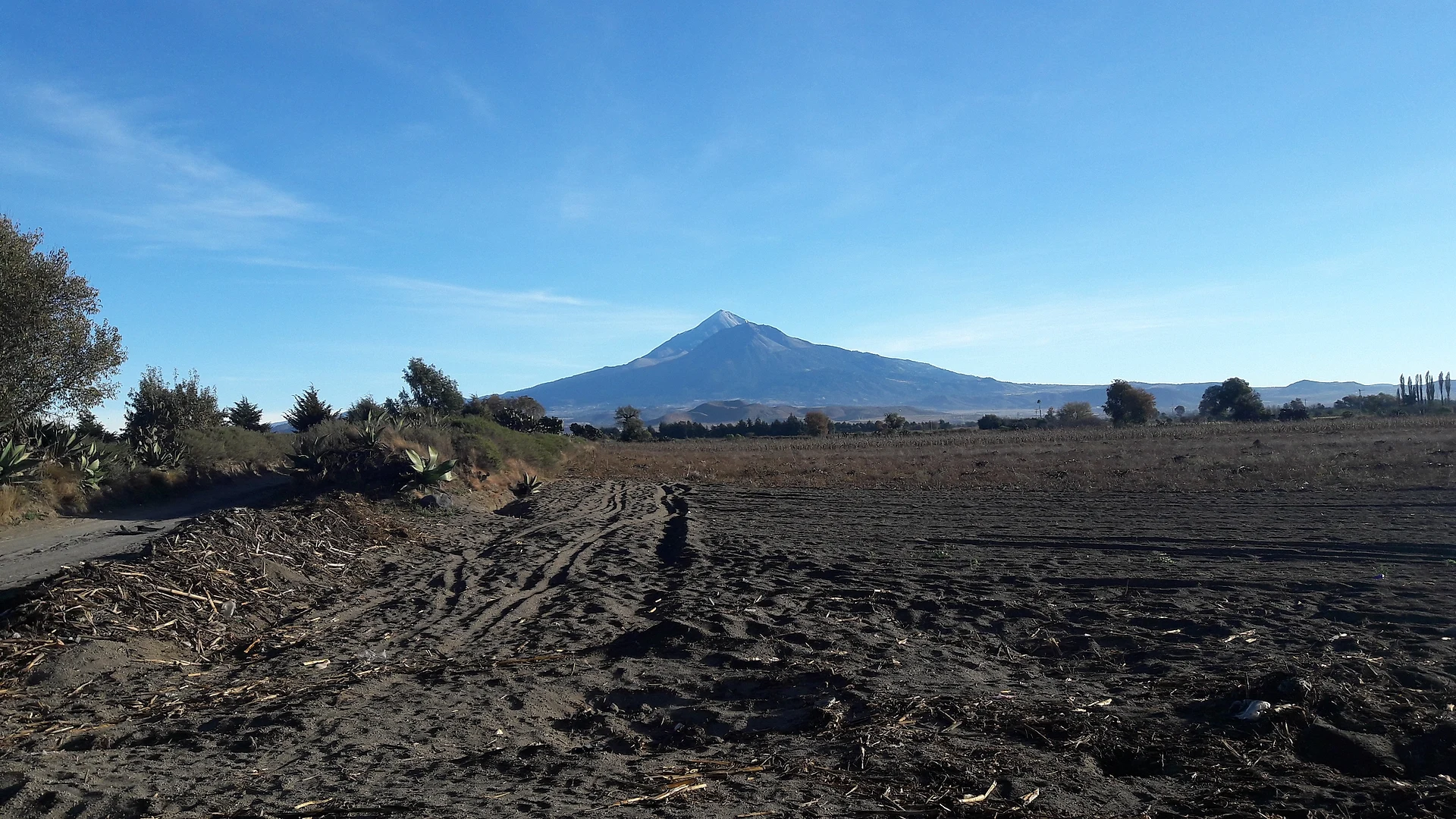
A 2,600 m town at the foot of Pico de Orizaba, where 4x4 trucks leave for the Piedra Grande hut at about 4,260 m.
From Orizaba: about 50 min by road (~55 km) How to get there ↓
Near here
See everything nearby ↓



Plan your visit to Tlachichuca
Where to stay near Tlachichuca
Compare hotels, posadas and guest houses in Tlachichuca.
Tours to Tlachichuca
Day trips around Coscomatepec sometimes stop in Tlachichuca; a tour is the easy way to see it without a car.
 Tours from Puebla City
Africam Safari Zoo Admission with Transportation
★ 4.8 (87) · From US$35
How to get to Tlachichuca
- From Orizaba: about 50 min by road (~55 km)
- Nearest airport: Veracruz (VER), 1 h 50 min by car to Coscomatepec
Links open a partner site. We may earn a commission if you book, at no cost to you.
Tours from Puebla City, near Tlachichuca


Tours, prices and ratings from Viator, checked weekly. We may earn a commission if you book.
About Tlachichuca
Tlachichuca is the seat of the municipality of the same name in eastern Puebla, at about 2,600 metres on the plains of San Andrés, with Citlaltépetl, or Pico de Orizaba, Mexico's highest mountain at 5,747 metres, rising to the southeast. The town had 8,481 residents in 2020. Its name is usually read from Nahuatl as "place of artisans"; a Totonac reading gives "place where tears spring". Totonacs and Nahuas lived in the area, and after the Spanish conquest the town of Santa María de la Peña Tlachichuca was founded here. It answered to Tepeaca and later to the Chalchicomula district; in May 1807 residents asked the viceroy for their town lands, and in 1895 it became a municipality in its own right.
For most climbers heading up Pico de Orizaba, Tlachichuca is where the trip begins. Local outfitters drive mountaineers in 4x4 trucks up to the Piedra Grande hut at roughly 4,260 metres, a steep and very rough road that takes about two hours. The Reyes family has hosted climbers for decades at Servimont, an alpine-style lodge set in a compound about 150 years old that includes a museum of its former soap factory.
In the centre stands the parish church of the Inmaculada Concepción, founded in the 16th century; its patron's feast falls on 8 December. The snow-capped volcano is visible from the town's streets. Other communities in the municipality include San Francisco Independencia and Santa Cecilia Tepetitlán, and to the northeast the land climbs into the Sierra de Quimixtlán, where the rivers drain toward the Gulf of Mexico.
How to get to Tlachichuca
Tlachichuca is in eastern Puebla, north of Ciudad Serdán. From Puebla it is 1 h 35 min and 105 km by road; from Huamantla, the nearest city, 1 h 5 min and 74 km, and from Teziutlán 1 h 30 min and 100 km. There is no direct bus: from Mexico City's TAPO, Autotransportes Tlaxcala, Apizaco, Huamantla (ATAH) runs to Cuapiaxtla three times a day (about two and a half hours) and to Alchichica every four hours; from either, continue by taxi to Tlachichuca. Or ride to Puebla's CAPU (ADO, AU and Estrella Roja leave TAPO every half hour) and take Autobuses Valles toward Ciudad Serdán, about 2 h 20 min, then a taxi. The town's climbing outfitters arrange transfers from Mexico City airport. The road from Tlachichuca to Piedra Grande is steep dirt track, for 4x4 only.
Directions to Tlachichuca on Google Maps
Distances are in a straight line; the road is usually longer.
Links open a partner site. We may earn a commission if you book, at no cost to you.
From the nearest cities to Tlachichuca
- Orizaba · about 55 km by road, ~50 min
- Huamantla · about 75 km by road, ~1 h 5 min
- Córdoba · about 75 km by road, ~1 h 5 min
Drive times by road from OpenStreetMap, without traffic or stops. Times marked ~ are estimated from the straight-line distance.
Before you go to Tlachichuca: hours, prices and tips
- Guide or tour
- Climbing Pico de Orizaba needs a CONANP permit and a municipal fee; guides and 4x4 trucks to Piedra Grande are hired in town. Tours: Viator GetYourGuide Global Summit Guide · checked Oct 2026
Hours and prices change, especially around holidays. Each fact links to where we checked it.
Visiting Tlachichuca: what to see and do
Pico de Orizaba, visible from the town's streets.
The Inmaculada Concepción parish church, founded in the 16th century.
The Servimont lodge and its old soap factory museum.
The 4x4 ride up to the Piedra Grande hut at about 4,260 m.
Plan your trip
Places to stay in Tlachichuca
Compare hotels, posadas, and rentals in and around Tlachichuca.
Tours & activities
Day trips around Coscomatepec sometimes stop in Tlachichuca; a tour is the easy way to see it without a car.
Rental cars
Pick up a car at VER (Veracruz): about 1 h 50 min by road to Coscomatepec, then 39 km more to Tlachichuca, on your own schedule.
Flights
The nearest airport with scheduled flights is Veracruz (VER), about 1 h 50 min by road from Coscomatepec, the base for Tlachichuca.
Mobile data
Signal can drop away from Coscomatepec: download a map of the way to Tlachichuca before you set out, or carry an eSIM with data.
Links open a partner site. We may earn a commission if you book, at no cost to you.
When to go to Tlachichuca mild
Tlachichuca shares the climate of Coscomatepec, 39 km away. The best months to visit are February, March, April, and December.
See the month-by-month climate of Coscomatepec
Weather in Tlachichuca now and the next 7 days
Live forecast from Open-Meteo. Chance of rain is the day's highest.
The closest Pueblo Mágico: Coscomatepec

Coscomatepec is the Pueblo Mágico closest to Tlachichuca, with places to stay, food, and more to see.
Also close to
Closest to Tlachichuca
-
Ahuatepec del Camino · Village · 8 km away
-
Aljojuca · Village · 12 km away
-
San Juan Arcos Ojo de Agua · Village · 13 km away
-
San Juan Atenco · Village · 13 km away
-
San Miguel Tecuitlapa · Village · 14 km away
-
Ciudad Serdán · Town · 15 km away
-
Pico de Orizaba · Mountain · 18 km away
-
Santa Cruz El Veladero · Village · 18 km away


Near Tlachichuca




Drive times by road from OpenStreetMap, without traffic. Times marked ~ are estimated from the straight-line distance.
Location from OpenStreetMap. Written by Puebloteca.