Village Huautla, Hidalgo Municipality of Huautla Hidalgo Huasteca
A Nahua community of 377 people at 556 m, about 9 km north of Huautla; its Santa Cruz fiesta is 2-3 May and Xantolo is the biggest of the year.
From Tulancingo: about 1 h 50 min by road (~125 km) How to get there ↓
Near here
See everything nearby ↓



Plan your visit to Zacatipa
Where to stay near Zacatipa
Compare hotels, posadas and guest houses in Zacatipa.
Tours to Zacatipa
Day trips and guided outings from Metztitlán often include Zacatipa; with a local guide you can get there without a car.
 Tours from Xilitla
Surrealist Garden of Edward James, Castle of Health and Xilitla Nativity
★ 4.3 (10) · From US$100
How to get to Zacatipa
- From Tulancingo: about 1 h 50 min by road (~125 km)
- Nearest airport: Mexico City (Felipe Ángeles) (NLU), 2 h 18 min by car to Metztitlán
Links open a partner site. We may earn a commission if you book, at no cost to you.
Tours from Xilitla, near Zacatipa


Tours, prices and ratings from Viator, checked weekly. We may earn a commission if you book.
About Zacatipa
Zacatipa is in the Hidalgo Huasteca, at 556 metres and about 9.4 km north of Huautla. It borders Piltepeco to the east and Acatepec to the west, 1.6 and 2.1 km away. In 2020 it had 377 residents, the municipality's thirteenth-largest locality, and many of them speak Nahuatl.
Its history goes back to the ceremonial route the Mexica walked from Tecacahuaco (now in Atlapexco) to Cerro Postectli, in Chicontepec, Veracruz; groups passing along it gradually settled, which is why no founder or exact date is known. It was recognised as a locality on 27 June 1836 and in 1844 was attached to Huautla. The original name was probably Zacaojtipa, "grass road", though many today explain it as "on the grassland".
The village calendar is dominated by Xantolo, followed by the patron fiesta of the Santa Cruz on 2 and 3 May. On the 2nd there are children's games at telesecundaria 286, the blessing of crosses decorated with the flor de Santa Cruz (a yellow orchid), a dance with a band and a wind ensemble, and fireworks with toritos; on the 3rd come the mañanitas and rosary, a noon procession through the main streets, mass, pot and firewood races (since 2024) and a second dance. The climate is temperate sub-humid, averaging about 22 °C, with rain from June to October and heat from April to June. The local authority is a delegate chosen each November at a community assembly.
How to get to Zacatipa
Zacatipa lies about 9.4 km north of Huautla, the municipal seat, which is the starting point and the place to ask about the road and transport. Its immediate neighbours are Piltepeco (1.6 km east) and Acatepec (2.1 km west), so either name helps in finding your way.
In a straight line Metztitlán is about 67 km away and Poza Rica (Veracruz) about 96 km (at least about 75 and 110 minutes; by road it will be more). If you are going for the Santa Cruz fiesta, 3 May is the main day and the procession leaves at noon.
Directions to Zacatipa on Google Maps
Distances are in a straight line; the road is usually longer.
Links open a partner site. We may earn a commission if you book, at no cost to you.
From the nearest cities to Zacatipa
- Tulancingo · about 125 km by road, ~1 h 50 min
- Pachuca · about 140 km by road, ~2 h
- Tuxpan · 126 km by road, 2 h 10 min
Drive times by road from OpenStreetMap, without traffic or stops. Times marked ~ are estimated from the straight-line distance.
Before you go to Zacatipa: hours, prices and tips
- Best time of day
- Temperatures average about 22 °C; April to June are the hottest months (above 35 °C at times) and December and January the coolest. Rain falls mostly June to October. Wikipedia: Zacatipa · checked Oct 2026
- Best season
- The Santa Cruz patron fiesta is on 2 and 3 May, with the main day on the 3rd (procession at noon, mass, then races and a dance); Xantolo is the village's biggest festival. Wikipedia: Zacatipa · checked Oct 2026
Hours and prices change, especially around holidays. Each fact links to where we checked it.
Visiting Zacatipa: what to see and do
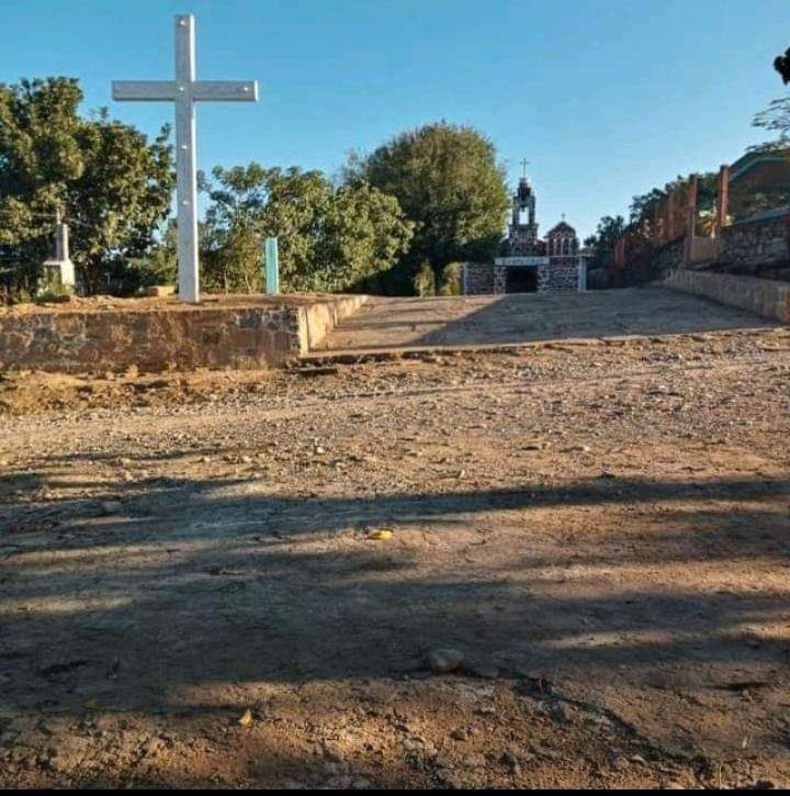
The chapel of the Santa Cruz, setting of the 2-3 May patron fiesta
Blessing of crosses with flor de Santa Cruz (a yellow orchid), the afternoon of 2 May
The 3 May procession and the pot and firewood races
Xantolo, the village's biggest festival, in late October and early November
The public shelter (galera) where the delegate is elected each November
Plan your trip
Places to stay in Zacatipa
Compare hotels, posadas, and rentals in and around Zacatipa.
Tours & activities
Day trips and guided outings from Metztitlán often include Zacatipa; with a local guide you can get there without a car.
Rental cars
Pick up a car at NLU (Mexico City (Felipe Ángeles)): about 2 h 18 min by road to Metztitlán, then 67 km more to Zacatipa, on your own schedule.
Flights
The nearest airport with scheduled flights is Mexico City (Felipe Ángeles) (NLU), about 2 h 18 min by road from Metztitlán, the base for Zacatipa.
Mobile data
Signal can drop away from Metztitlán: download a map of the way to Zacatipa before you set out, or carry an eSIM with data.
Links open a partner site. We may earn a commission if you book, at no cost to you.
When to go to Zacatipa mild
Zacatipa shares the climate of Metztitlán, 67 km away. The best months to visit are January, February, March, and December.
See the month-by-month climate of Metztitlán
Weather in Zacatipa now and the next 7 days
Live forecast from Open-Meteo. Chance of rain is the day's highest.
The closest Pueblo Mágico: Metztitlán

Metztitlán is the Pueblo Mágico closest to Zacatipa, with places to stay, food, and more to see.
Also close to
Closest to Zacatipa
-
Huazalinguillo · Village · 4 km away
-
Texoloc · Village · 4 km away
-
Tamoyón I · Village · 8 km away
-
Atlalco · Village · 9 km away
-
Chicontepec · Town · 9 km away
-
Huautla · Village · 10 km away
-
Ahuehuetl · Village · 11 km away
-
Pahactla · Village · 11 km away


Near Zacatipa


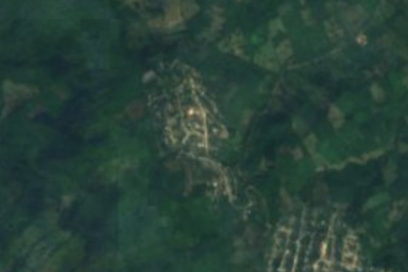







Drive times by road from OpenStreetMap, without traffic. Times marked ~ are estimated from the straight-line distance.
Location from OpenStreetMap. Written by Puebloteca.