

Mountain Perote, Veracruz Municipality of Perote Xalapa and the coffee hills
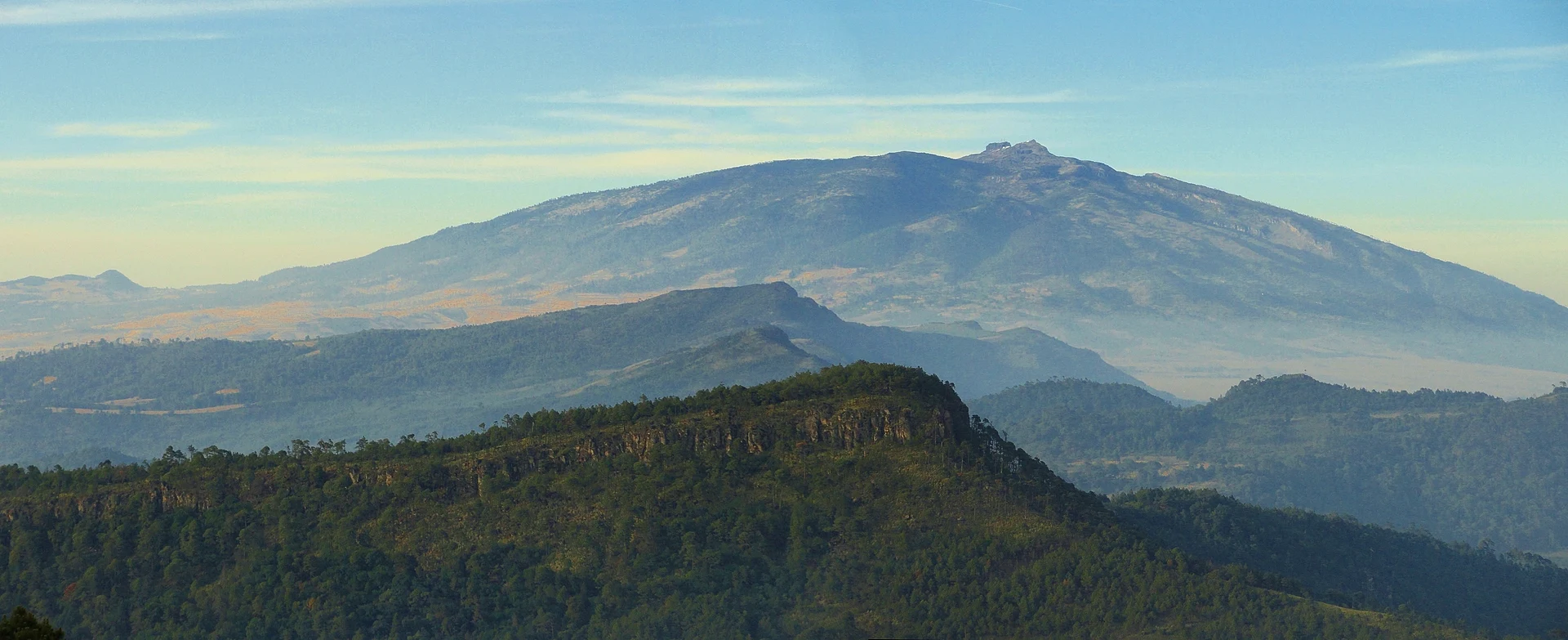
The 4,282 m volcano that looms over Xico, a national park of pine and fir forest with a road almost to the rocky summit.
From Xalapa: 1 h 15 min by car (64 km by road) How to get there ↓
Near here
See everything nearby ↓



Plan your visit to Cofre de Perote
Where to stay near Cofre de Perote
Xico, 18 km away, is the closest town with places to stay.
Las Magdalenas Hotel Boutique Hotel · ★★★ · 790 m from the center Prices Hotel Coyopolan Hotel · ★★★ · 1.1 km from the center PricesTours to Cofre de Perote
Day trips and guided outings from Xico often include Cofre de Perote; with a local guide you can get there without a car.
How to get to Cofre de Perote
- From Xalapa: about 1 h 15 min by road (~64 km)
- 18 km northwest of Xico
- Nearest airport: Veracruz (VER), 1 h 44 min by car to Xico
Links open a partner site. We may earn a commission if you book, at no cost to you.
About Cofre de Perote
The Cofre de Perote is the big, flat-shouldered mountain on Xico's western horizon. At 4,282 meters it is one of the highest peaks in Mexico, an old shield volcano whose Nahuatl name, Nauhcampatépetl, is usually translated as "the four-sided mountain." The Spanish name comes from the block of rock at the summit, which looks like a chest, or cofre.
The mountain has been a national park since 1937, covering about 11,700 hectares of pine and sacred fir (oyamel) forest. Xico itself sits on its lower, wetter slopes, so climbing the Cofre means passing from coffee and cloud forest up into cold, dry highland woods, where frost is common and snow falls on some winter days.
Most visitors go up from the Perote side, through the village of El Conejo, at about 3,250 meters. From there a rough road climbs toward the antennas near the top, and the last stretch to the rock is a short walk. On clear mornings the view takes in the Pico de Orizaba to the south and, on the best days, all the way to the Gulf.
How to get to Cofre de Perote
Drive from Xalapa: 1 h 15 min, 64 km
Although the Cofre rises right behind Xico, there is no easy road up from this side. The usual route is to drive to Xalapa and take Highway 140 toward Perote, then turn off near Las Vigas or Perote for El Conejo; plan on roughly two hours from Xico. The road above El Conejo is rough, a high-clearance vehicle helps, and the local community may charge a per-person fee. Go early, bring warm clothes, and take it slow: the altitude is over 4,000 meters.
18 km northwest of Xico
Directions from Xico on Google Maps
Distances are in a straight line; the road is usually longer.
Links open a partner site. We may earn a commission if you book, at no cost to you.
From the nearest cities to Cofre de Perote
- Xalapa · 64 km by road, 1 h 15 min
- Teziutlán · 73 km by road, 1 h 40 min
- Martínez de la Torre · 104 km by road, 2 h 10 min
Drive times by road from OpenStreetMap, without traffic or stops. Times marked ~ are estimated from the straight-line distance.
Before you go to Cofre de Perote: hours, prices and tips
- Best season
- Winter brings frost, freezing fog and sometimes snow; the park was closed by the Perote authorities in January 2026 when temperatures fell to -9 °C. Check for closures before going up between November and February. Excélsior · checked Oct 2026
- Guide or tour
- Hiring a local guide is recommended so you don't get lost in the forest. Tours: Viator GetYourGuide México Desconocido · checked Oct 2026
- What to bring
- Warm layers, water and high-energy food, and a vehicle fit for dirt roads. Milenio (Protección Civil Veracruz) · checked Oct 2026
- Rules
- Stay on marked roads and trails, no campfires, no alcohol, and no entry to the antenna zone at the summit. People with heart or blood-pressure problems are advised not to go up. Milenio (Protección Civil Veracruz) · checked Oct 2026
Hours and prices change, especially around holidays. Each fact links to where we checked it.
Visiting Cofre de Perote: what to see and do
Drive or hike up from El Conejo and walk the last stretch to the rock that gives the mountain its name.
Hike through the pine and fir forest of the national park.
Look south for the Pico de Orizaba on a clear morning.
Camp or stay in cabins at an ecotourism center on the Las Vigas side, such as Valle Alegre.
Plan your trip
Places to stay in Cofre de Perote
Compare hotels, posadas, and rentals in and around Cofre de Perote.
Tours & activities
Day trips and guided outings from Xico often include Cofre de Perote; with a local guide you can get there without a car.
Rental cars
Pick up a car at VER (Veracruz): about 1 h 44 min by road to Xico, then 18 km more to Cofre de Perote, on your own schedule.
Flights
The nearest airport with scheduled flights is Veracruz (VER), about 1 h 44 min by road from Xico, the base for Cofre de Perote.
Travel insurance
If you plan on hiking at altitude at Cofre de Perote, check that your policy covers it: some plans leave adventure activities out.
Mobile data
Signal can drop away from Xico: download a map of the way to Cofre de Perote before you set out, or carry an eSIM with data.
Links open a partner site. We may earn a commission if you book, at no cost to you.
Photos
When to go to Cofre de Perote mild
Cofre de Perote shares the climate of Xico, 18 km away. The best months to visit are February, March, April, and May.
For the clearest views from Cofre de Perote, go in the driest months (February, March, April, and May); in the rains, clouds tend to build up by midday.
See the month-by-month climate of Xico
Weather in Cofre de Perote now and the next 7 days
Live forecast from Open-Meteo. Chance of rain is the day's highest.
Make Xico your base

Cofre de Perote is an easy trip from Xico, a Pueblo Mágico with places to stay, food, and more to see.
Also close to
- Coatepec · Veracruz · 20 km away
- Naolinco · Veracruz · 34 km away
- Teziutlán · Puebla · 46 km away
- Coscomatepec · Veracruz · 48 km away
- Tlatlauquitepec · Puebla · 54 km away
Closest to Cofre de Perote
-
La Toma · Village · 7 km away · Veracruz
-
Los Pescados · Village · 7 km away · Veracruz
-
Los Altos · Village · 8 km away · Veracruz
-
El Paisano · Village · 10 km away · Veracruz
-
Perote · Town · 12 km away · Veracruz
-
Fortaleza de San Carlos · Landmark · 13 km away
-
La Gloria · Village · 18 km away · Veracruz
-
La Joya · Village · 18 km away · Veracruz


Near Cofre de Perote


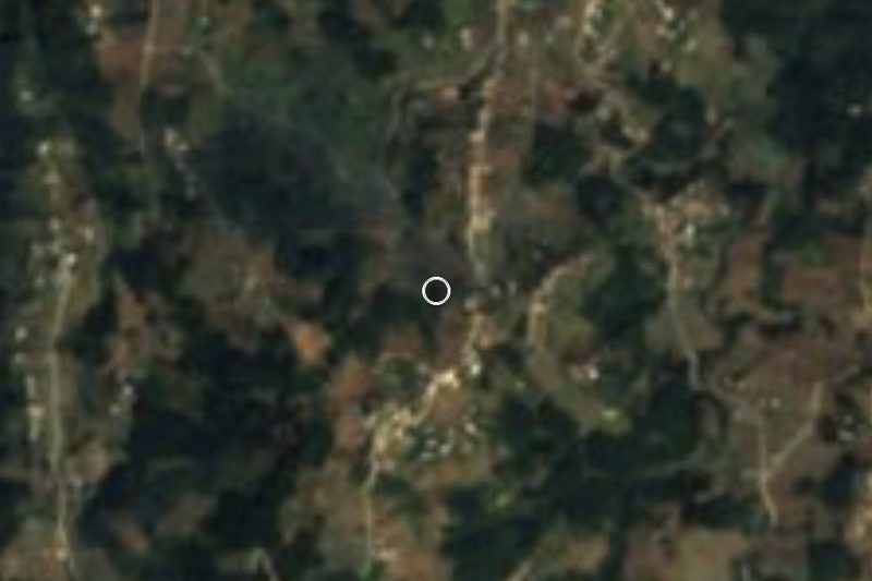


Drive times by road from OpenStreetMap, without traffic. Times marked ~ are estimated from the straight-line distance.
Lists with Cofre de Perote
Mountains near Xico · 4 Mountains near Teziutlán · 3 Mountains near Coscomatepec · 4Something wrong or missing on this page? Suggest a fix or addition
Location from OpenStreetMap. Written by Puebloteca.