
Village Ayahualulco, Veracruz Xalapa and the coffee hills
Mountain village at almost 2,900 m on the slopes of the Cofre de Perote, Ayahualulco's most populous place; San Juan feast on 24 June.
From Xalapa: 1 h 5 min by car (72 km by road) How to get there ↓
Near here
See everything nearby ↓



Plan your visit to Los Altos
Where to stay near Los Altos
Compare hotels, posadas and guest houses in Los Altos.
Tours to Los Altos
Day trips and guided outings from Xico often include Los Altos; with a local guide you can get there without a car.
How to get to Los Altos
- From Xalapa: about 1 h 5 min by road (~72 km)
- Nearest airport: Veracruz (VER), 1 h 44 min by car to Xico
Links open a partner site. We may earn a commission if you book, at no cost to you.
About Los Altos
Los Altos ("the heights") lives up to its name: it sits at almost 2,900 metres above sea level on the slopes of the Cofre de Perote volcano, in the high, cold country of central Veracruz. It belongs to the municipality of Ayahualulco but is larger than the municipal seat: the 2020 census counted 4,556 people here against 2,823 in Ayahualulco, making it the most populous place in the municipality.
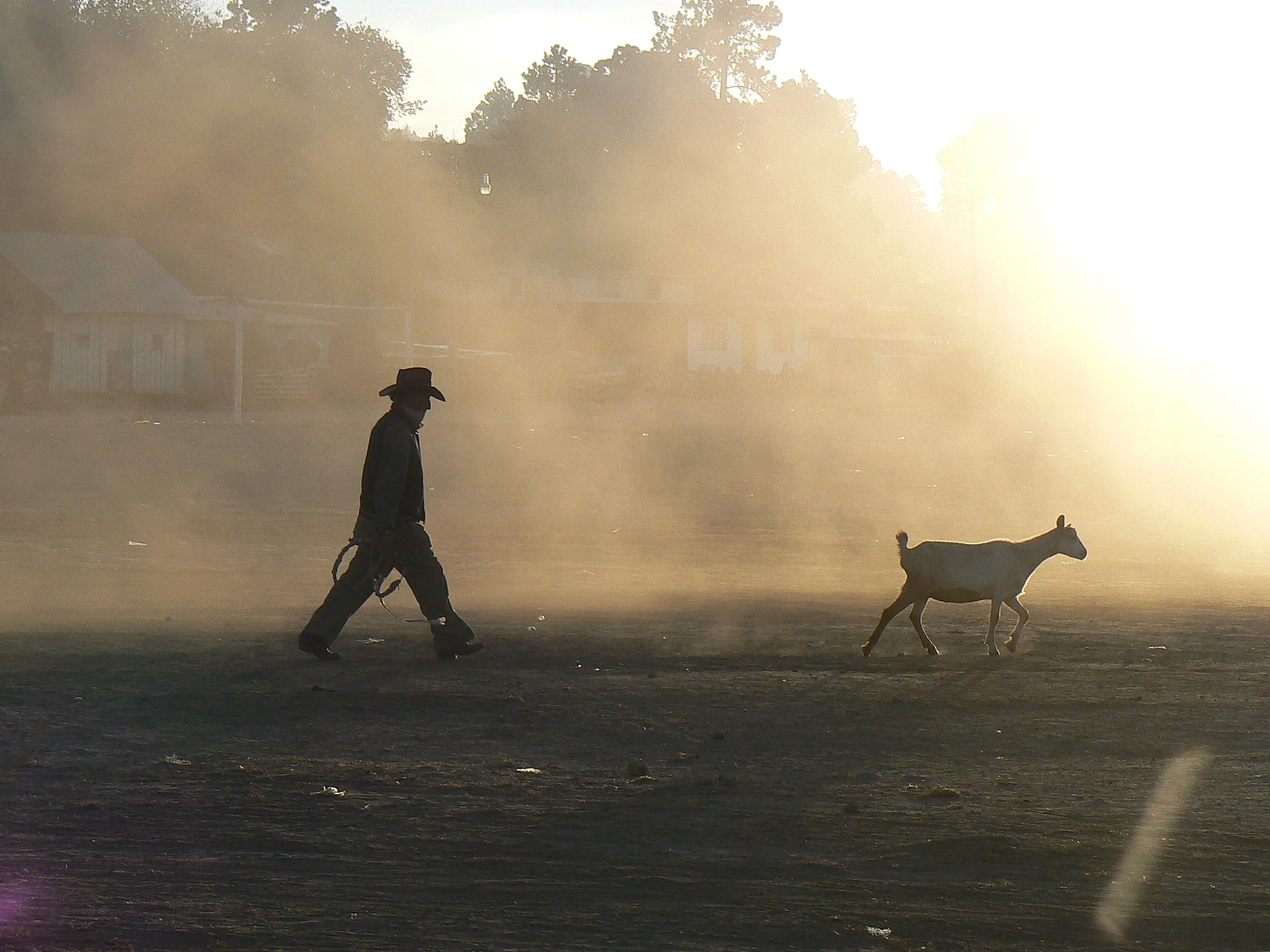
This is volcanic mountain country. Ayahualulco ranges from 1,200 to 4,200 metres, on volcanic rock and dark ash soils that are almost all given over to farming, and the upper reaches have cool to cold climates with summer rain. Maize and potatoes are the main crops, and on the open ground around the village you may meet cowboys driving goats beneath the volcano.
The village's calendar turns on one date: 24 June, the patronal feast of Saint John the Baptist. A month later, from 24 to 27 July, the municipal seat honours Saint James with dances, horse races, rodeo-style jaripeos and processions on horseback. The municipality's name comes from Nahuatl atl (water), yahualli (something round) and co (place), roughly "place of the lake".
How to get to Los Altos
Drive from Xalapa: 1 h 5 min, 72 km
The most direct approach is from Perote: about 21 km, some 25 minutes, leaving on Federal Highway 140 and then taking the local road south to Los Altos. From Xalapa it is about 72 km, roughly an hour, on the 140D toll road to Perote and then the same road. From Xico, the nearest Pueblo Mágico, a mountain route along the Xico–Tonalaco road covers about 36 km and takes over an hour. By bus, Xalapa's CAXA terminal has frequent departures to Perote, about an hour away; from Perote continue by local transport or taxi. Bring warm clothes: the climate at this altitude is cool to cold.
Directions to Los Altos on Google Maps
Distances are in a straight line; the road is usually longer.
Links open a partner site. We may earn a commission if you book, at no cost to you.
From the nearest cities to Los Altos
- Xalapa · 72 km by road, 1 h 5 min
- Teziutlán · 70 km by road, 1 h 10 min
- Córdoba · about 90 km by road, ~1 h 20 min
Drive times by road from OpenStreetMap, without traffic or stops. Times marked ~ are estimated from the straight-line distance.
Visiting Los Altos: what to see and do
The slopes of the Cofre de Perote rising above the village.
The mountain potato and maize fields.
The patronal feast of Saint John the Baptist, 24 June.
The feast of Saint James in Ayahualulco, 24 to 27 July.
Plan your trip
Places to stay in Los Altos
Compare hotels, posadas, and rentals in and around Los Altos.
Tours & activities
Day trips and guided outings from Xico often include Los Altos; with a local guide you can get there without a car.
Rental cars
Pick up a car at VER (Veracruz): about 1 h 44 min by road to Xico, then 21 km more to Los Altos, on your own schedule.
Flights
The nearest airport with scheduled flights is Veracruz (VER), about 1 h 44 min by road from Xico, the base for Los Altos.
Mobile data
Signal can drop away from Xico: download a map of the way to Los Altos before you set out, or carry an eSIM with data.
Links open a partner site. We may earn a commission if you book, at no cost to you.
When to go to Los Altos mild
Los Altos shares the climate of Xico, 21 km away. The best months to visit are February, March, April, and May.
See the month-by-month climate of Xico
Weather in Los Altos now and the next 7 days
Live forecast from Open-Meteo. Chance of rain is the day's highest.
The closest Pueblo Mágico: Xico

Xico is the Pueblo Mágico closest to Los Altos, with places to stay, food, and more to see.
Also close to
- Coatepec · Veracruz · 26 km away
- Naolinco · Veracruz · 42 km away
- Coscomatepec · Veracruz · 45 km away
- Teziutlán · Puebla · 48 km away
- Tlatlauquitepec · Puebla · 54 km away
Closest to Los Altos
-
La Toma · Village · 1 km away
-
Cofre de Perote · Mountain · 8 km away
-
La Gloria · Village · 10 km away
-
González Ortega · Village · 14 km away
-
Los Pescados · Village · 14 km away
-
Perote · Town · 14 km away
-
Fortaleza de San Carlos · Landmark · 15 km away
-
El Paisano · Village · 18 km away

Near Los Altos


Drive times by road from OpenStreetMap, without traffic. Times marked ~ are estimated from the straight-line distance.
Location from OpenStreetMap. Written by Puebloteca.