

Village Perote, Veracruz Municipality of Perote Xalapa and the coffee hills
A Perote Valley village at 2,460 m with an old hacienda chapel, named in 2009 as the possible starting point of the H1N1 flu outbreak.
From Xalapa: 1 h 5 min by car (75 km by road) How to get there ↓
Near here
See everything nearby ↓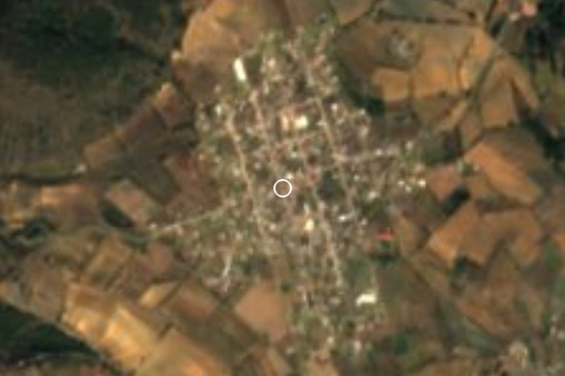


Plan your visit to La Gloria
Where to stay near La Gloria
Compare hotels, posadas and guest houses in La Gloria.
Tours to La Gloria
Day trips and guided outings from Xico often include La Gloria; with a local guide you can get there without a car.
How to get to La Gloria
- From Xalapa: about 1 h 5 min by road (~75 km)
- Nearest airport: Veracruz (VER), 1 h 44 min by car to Xico
Links open a partner site. We may earn a commission if you book, at no cost to you.
About La Gloria
La Gloria is a farming village in the municipality of Perote, set in the mountain-ringed Perote Valley south-west of the Cofre de Perote volcano. At about 2,460 metres it sits in one of the highest and coldest parts of Veracruz: the annual mean temperature is around 13.5 °C, and in January 2008 just over 4 cm of snow fell. The 2020 census counted 2,719 people. Farming is the main livelihood, and about half the population spends the working week in Mexico City, some 200 km to the west.
From its past the village keeps the chapel of the former Hacienda de La Gloria, a white-walled church with a bell tower capped by a small dome, listed among Mexico's historic monuments.
In April 2009 the village's name went round the world. About 8.5 km away is the pig-farming operation of Granjas Carroll de México, which raised nearly a million pigs in 2008 and had been the target of local protests. A wave of respiratory illness hit the village from December 2008, and in March a local boy became a confirmed case of the new virus; he recovered and became known as "patient zero". Several sources pointed to La Gloria as the origin of the H1N1 swine flu epidemic, but the Veracruz government denied it, and in May 2009 Mexico's agriculture ministry said it had found no trace of the virus in local pigs; no link has ever been proven. On 16 August 2009 a statue of the boy was unveiled in the central park.
How to get to La Gloria
Drive from Xalapa: 1 h 5 min, 75 km
La Gloria is linked to Perote by a secondary road that meets Federal Highway 140, the road to Xalapa, in that town. From Perote it is about 24 km and half an hour: take Highway 140 towards Puebla for about 3 km, then the local road south through the valley villages. From Xalapa it is about 75 km and just over an hour: take the Puebla–Xalapa toll road (140D) to Perote and then the same road. Xico, the nearest Pueblo Mágico, is about 49 km away on the mountain road via Tonalaco (roughly 1 h 20 min). Buses run between Xalapa and Perote throughout the day and take about an hour.
Directions to La Gloria on Google Maps
Distances are in a straight line; the road is usually longer.
Links open a partner site. We may earn a commission if you book, at no cost to you.
From the nearest cities to La Gloria
- Xalapa · 75 km by road, 1 h 5 min
- Teziutlán · 73 km by road, 1 h 10 min
- Huamantla · 82 km by road, 1 h 15 min
Drive times by road from OpenStreetMap, without traffic or stops. Times marked ~ are estimated from the straight-line distance.
Visiting La Gloria: what to see and do
See the white chapel of the former Hacienda de La Gloria.
Find the statue of the "patient zero" boy in the central park, unveiled in 2009.
Take in the Perote Valley, with the Cofre de Perote to the north-east.
Visit the San Carlos fortress in the town of Perote.
Plan your trip
Places to stay in La Gloria
Compare hotels, posadas, and rentals in and around La Gloria.
Tours & activities
Day trips and guided outings from Xico often include La Gloria; with a local guide you can get there without a car.
Rental cars
Pick up a car at VER (Veracruz): about 1 h 44 min by road to Xico, then 30 km more to La Gloria, on your own schedule.
Flights
The nearest airport with scheduled flights is Veracruz (VER), about 1 h 44 min by road from Xico, the base for La Gloria.
Mobile data
Signal can drop away from Xico: download a map of the way to La Gloria before you set out, or carry an eSIM with data.
Links open a partner site. We may earn a commission if you book, at no cost to you.
When to go to La Gloria mild
La Gloria shares the climate of Xico, 30 km away. The best months to visit are February, March, April, and May.
See the month-by-month climate of Xico
Weather in La Gloria now and the next 7 days
Live forecast from Open-Meteo. Chance of rain is the day's highest.
The closest Pueblo Mágico: Xico

Xico is the Pueblo Mágico closest to La Gloria, with places to stay, food, and more to see.
Also close to
- Coatepec · Veracruz · 35 km away
- Coscomatepec · Veracruz · 44 km away
- Naolinco · Veracruz · 52 km away
- Teziutlán · Puebla · 52 km away
- Tlatlauquitepec · Puebla · 55 km away
Closest to La Gloria
-
González Ortega · Village · 6 km away
-
Los Altos · Village · 10 km away
-
La Toma · Village · 11 km away
-
Saltillo · Village · 11 km away
-
Chichicuautla · Village · 12 km away
-
Guadalupe Victoria · Town · 13 km away
-
San Agustín · Village · 14 km away
-
Tlanalapan · Village · 16 km away


Near La Gloria






Drive times by road from OpenStreetMap, without traffic. Times marked ~ are estimated from the straight-line distance.
Location from OpenStreetMap. Written by Puebloteca.