
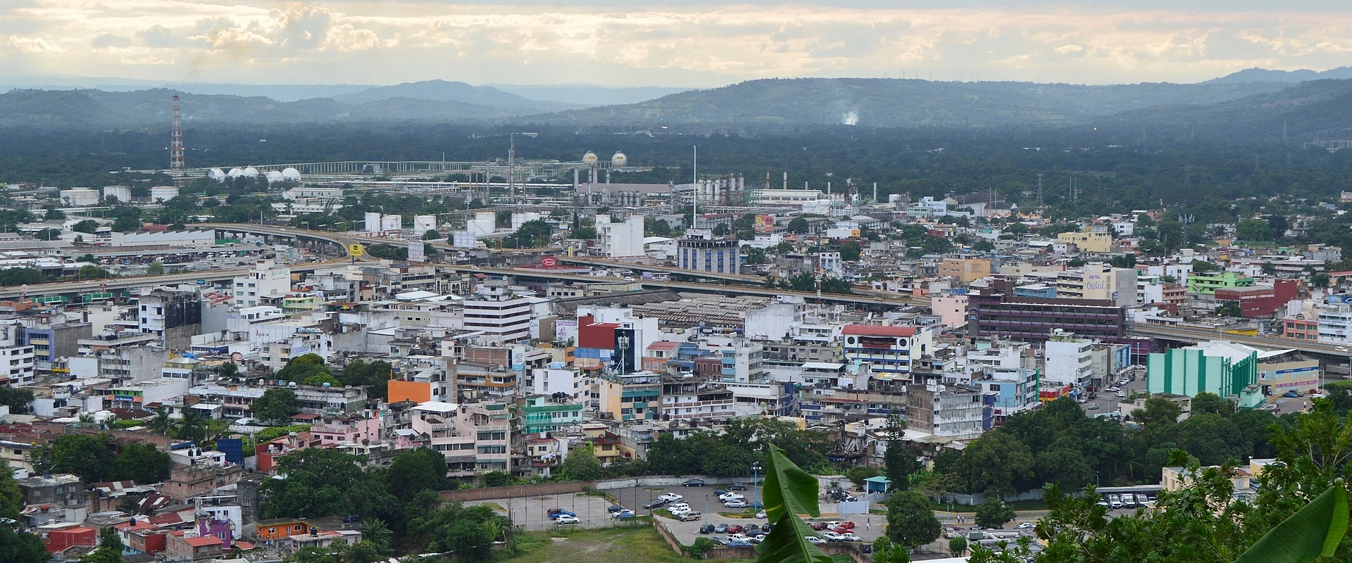
City Poza Rica de Hidalgo, Veracruz Totonacapan
Northern Veracruz's oil city, born of a 1930 gusher, with a Pablo O'Higgins mural and El Tajín 15 km away.
From Papantla: 30 min by car (21 km by road) How to get there ↓
Near here
See everything nearby ↓



Plan your visit to Poza Rica de Hidalgo
Where to stay near Poza Rica de Hidalgo
Compare hotels, posadas and guest houses in Poza Rica de Hidalgo.
Tours to Poza Rica de Hidalgo
Day trips and guided outings from Papantla often include Poza Rica de Hidalgo; with a local guide you can get there without a car.
How to get to Poza Rica de Hidalgo
- From Papantla: about 30 min by road (~21 km)
- Nearest airport: Poza Rica (PAZ), 2 h 45 min by car to Papantla
Links open a partner site. We may earn a commission if you book, at no cost to you.
About Poza Rica de Hidalgo
Poza Rica de Hidalgo is the largest city in northern Veracruz: it had 189,457 people at the 2020 census, and its metropolitan area, spilling into Coatzintla, Tihuatlán, Papantla and Cazones, passes half a million. The centre sits in a small valley of the Cazones River basin at about 60 metres, and newer districts climb the hills to the northeast. It is a young city with no colonial buildings; it lives from oil, trade and services for the whole region, including nearby towns in Puebla.
Traces of settlement from around AD 800 were found in 2011 in the old Arroyo del Maíz ejido. By 1871 Poza Rica was a Totonac community in Coatzintla municipality, named after a pool on the Cazones that was thick with fish. In the early 1900s a narrow-gauge railway from Cobos, the port of Tuxpan, to the Furbero oil fields passed through, and the hamlet was known as kilometre 56. In 1930 the El Águila company struck the Poza Rica No. 2 well, so rich that in December 1932 it moved its camp here from Palma Sola, and workers from all over the country came in on the little Cobos-Furbero train.
The oil workers organised what became Section 30 of the national union; in 1937 they held a 57-day strike against El Águila, and a delegation asked Lázaro Cárdenas to expropriate the field, which he did on 18 March 1938. In the 1940s Poza Rica was called Mexico's oil capital. Accidents left their mark: in 1947 the worker Adolfo Rendón put out the fire at the Poza Rica 6 well and asked only for a school for his neighbourhood as a reward, and in November 1950 a hydrogen sulphide leak killed 25 people. After a fire in Poza de Cuero, residents campaigned to break away from Coatzintla, and the municipality of Poza Rica de Hidalgo was created on 13 November 1951. The city is now the headquarters of Pemex's Northern exploration and production region.
Its most important artwork is Pablo O'Higgins's outdoor mural on the Palacio Municipal, unveiled on 18 March 1959: 5 by 47 metres, made of more than 11,000 ceramic tiles. The Parque de las Américas on the Cerro del Abuelo has the best view over the valley and the flare stacks that lit the city in its early years. Food mixes Totonac and Huasteca cooking: zacahuil, bocoles, molotes, enchiladas, estrujadas, zaragalla tamales and shrimp huatape. For visitors, Poza Rica is the practical base for El Tajín, 15 km away, and for the beaches at Cazones, Tuxpan and Tecolutla.
How to get to Poza Rica de Hidalgo
Drive from Papantla: 30 min, 21 km
From Mexico City it is about 268 km and 3 hours 40 minutes: leave on highway 85D towards Pachuca, continue on the 132D and 132 past Tulancingo, then the Mexico-Tuxpan toll road (132D) to the junction with Federal Highway 130, which enters the city over the Cazones II bridge. Tuxpan is about 57 km away (50 minutes), Papantla about 21 km on Federal Highway 180 (under half an hour) and Xalapa about 220 km (some 3 hours). By bus, the Central de Autobuses is served by more than 30 lines (ADO, ADO GL, ADO Platino, AU, Estrella Blanca, Primera Plus, Futura and others) to Mexico City and the rest of the country; a downtown ADO terminal handles the Tuxpan route, the terminal in colonia Petromex has departures south (Xalapa, Veracruz, Coatzacoalcos, Villahermosa), and buses for the Totonacapan hills and the El Tajín ruins leave from the Parador Urbano. El Tajín national airport, 12 km away in Tihuatlán, currently has no commercial flights.
Directions to Poza Rica de Hidalgo on Google Maps
Distances are in a straight line; the road is usually longer.
Links open a partner site. We may earn a commission if you book, at no cost to you.
From the nearest cities to Poza Rica de Hidalgo
- Papantla · 21 km by road, 30 min
- Tuxpan · 56 km by road, 45 min
- Martínez de la Torre · 101 km by road, 1 h 20 min
Drive times by road from OpenStreetMap, without traffic or stops. Times marked ~ are estimated from the straight-line distance.
Visiting Poza Rica de Hidalgo: what to see and do
Pablo O'Higgins's mural on the Palacio Municipal (1959)
The view from the Parque de las Américas on the Cerro del Abuelo
Plaza Cívica 18 de Marzo, the central square
Parque Juárez and the Francisco Lira Lara library
Zacahuil, bocoles and shrimp huatape in the markets
The El Tajín archaeological site, 15 km away
The beaches at Cazones, Tuxpan and Tecolutla
Plan your trip
Places to stay in Poza Rica de Hidalgo
Compare hotels, posadas, and rentals in and around Poza Rica de Hidalgo.
Tours & activities
Day trips and guided outings from Papantla often include Poza Rica de Hidalgo; with a local guide you can get there without a car.
Rental cars
Pick up a car at PAZ (Poza Rica): about 2 h 45 min by road to Papantla, then 16 km more to Poza Rica de Hidalgo, on your own schedule.
Flights
The nearest airport with scheduled flights is Poza Rica (PAZ), about 2 h 45 min by road from Papantla, the base for Poza Rica de Hidalgo.
Mobile data
Signal can drop away from Papantla: download a map of the way to Poza Rica de Hidalgo before you set out, or carry an eSIM with data.
Links open a partner site. We may earn a commission if you book, at no cost to you.
When to go to Poza Rica de Hidalgo warm
Poza Rica de Hidalgo shares the climate of Papantla, 16 km away. The best months to visit are February, March, April, and December.
See the month-by-month climate of Papantla
Weather in Poza Rica de Hidalgo now and the next 7 days
Live forecast from Open-Meteo. Chance of rain is the day's highest.
The closest Pueblo Mágico: Papantla

Papantla is the Pueblo Mágico closest to Poza Rica de Hidalgo, with places to stay, food, and more to see.
Also close to
- Zozocolco · Veracruz · 46 km away
- Cuetzalan · Puebla · 58 km away
- Xicotepec · Puebla · 60 km away
- Huauchinango · Puebla · 74 km away
- Tlatlauquitepec · Puebla · 76 km away
Closest to Poza Rica de Hidalgo
-
General Lázaro Cárdenas del Río · Village · 6 km away
-
Corralillos · Village · 10 km away
-
El Tajín · Archaeological site · 12 km away
-
Cristo Redentor · Landmark · 22 km away
-
Tihuatlán · Town · 22 km away
-
Venustiano Carranza · Village · 23 km away
-
El Volador · Village · 24 km away
-
Ciudad de Lázaro Cárdenas · Town · 27 km away
Near Poza Rica de Hidalgo


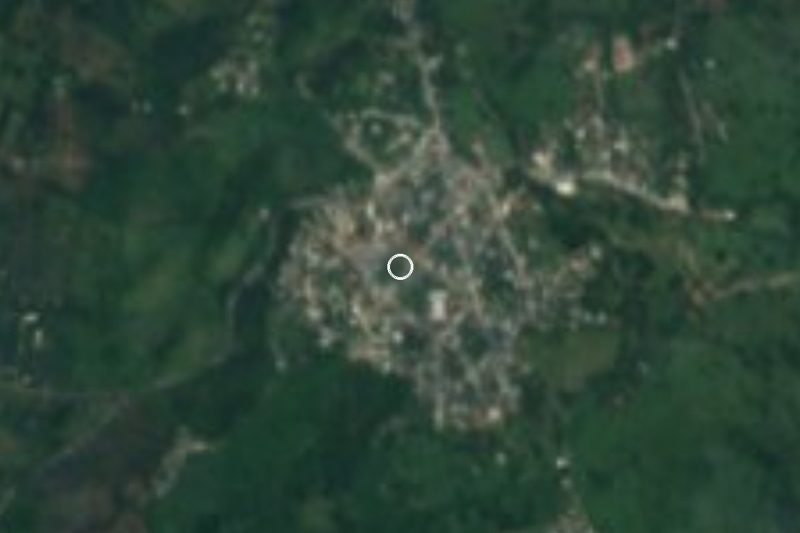


Drive times by road from OpenStreetMap, without traffic. Times marked ~ are estimated from the straight-line distance.
Location from OpenStreetMap. Written by Puebloteca.