
Town Temixco, Morelos Municipality of Temixco Southern Morelos
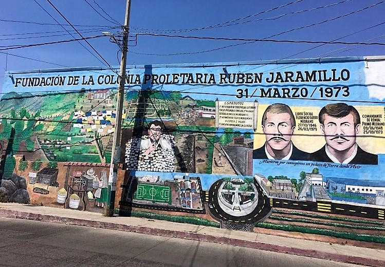
Temixco colonia born on 31 March 1973 from a land occupation; named for the peasant leader Rubén Jaramillo, killed in 1962.
From Cuernavaca: 15 min by car (11 km by road) How to get there ↓
Near here


Plan your visit to Rubén Jaramillo
Where to stay near Rubén Jaramillo
Compare hotels, posadas and guest houses in Rubén Jaramillo.
Tours to Rubén Jaramillo
Day trips around Xochitepec sometimes stop in Rubén Jaramillo; a tour is the easy way to see it without a car.
How to get to Rubén Jaramillo
- From Cuernavaca: about 15 min by road (~11 km)
- Nearest airport: Toluca (TLC), 1 h 59 min by car to Xochitepec
Links open a partner site. We may earn a commission if you book, at no cost to you.
About Rubén Jaramillo
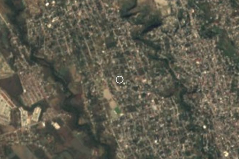
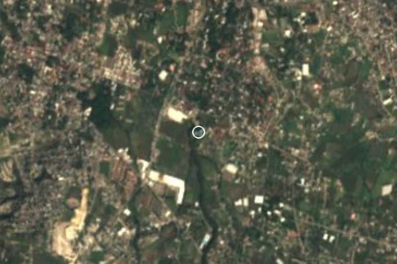
Colonia Proletaria Rubén Jaramillo, which its residents call "la Jara", sits in the municipality of Temixco, next to the village of Acatlipa and a little over 10 km south of Cuernavaca. It did not begin as a housing development but as a land occupation: on the night of Saturday 31 March 1973, a group led by 27-year-old Florencio Medrano Mederos, known as "el Güero", took roughly 68 hectares that had been earmarked for a luxury subdivision called Villa de las Flores. The land had been part of the Acatlipa ejido. Within weeks thousands had arrived, and 200-square-metre lots were handed out to families with no home.
An assembly of settlers picked the name and added "Proletaria". Rubén Jaramillo was a former Zapatista and a peasant leader from Morelos; on 23 May 1962 he was taken from his house in Tlaquiltenango and killed near the ruins of Xochicalco, together with his pregnant wife and their sons. The colonia ran on general assemblies and a struggle committee, and its collective Sunday work days built a school, a dispensary, bridges and roads. The land was split into three sections, Los Pinos, El Centro and La Nopalera, with 57 blocks. On 28 September 1973 more than a thousand soldiers entered the colonia, and the military siege lasted about seven years. Medrano was murdered in 1979.
Today it is a consolidated urban area, with services the residents won through collective effort, and the memory of the origin is still kept: around 31 March each year there is a march and a party with chinelo dancers, and 2026 marked the 53rd. To understand the place, read Ricardo Yanuel Fuentes's book on the colonia and Medrano (INEHRM, 2023), a free download. It is not a tourist destination with sights set up for visitors; it is a neighbourhood with an unusual political history, a short ride from Acatlipa.
How to get to Rubén Jaramillo
Drive from Cuernavaca: 15 min, 11 km
The colonia is a little over 10 km south of Cuernavaca, in Temixco, and about 1.5 km north-west of Acatlipa. By car allow roughly 15 to 20 minutes from Cuernavaca (approx.): take the Acapulco road towards Temixco and, for the last stretch, follow the signs to Acatlipa and ask for "la Jara"; We found no official signage I can cite. Xochitepec, the nearest pueblo, is about 9 km as the crow flies, approx. 15 minutes by car.
Coming from the capital, the route is the Autopista del Sol (95D) to Cuernavaca and then south; Pullman de Morelos buses cover that stretch from Taxqueña. In Cuernavaca, city route 11 ends its run in Temixco at the colonia's roundabout, according to Azteca Morelos. A caution: in 2024 the press reported that route 11 suspended or cut its service in several Temixco colonias, this one among them, after threats against drivers, and We could not confirm whether it has returned to normal. Check before you go, or take a taxi or ride-hailing car to the colonia.
Directions to Rubén Jaramillo on Google Maps
Distances are in a straight line; the road is usually longer.
Links open a partner site. We may earn a commission if you book, at no cost to you.
From the nearest cities to Rubén Jaramillo
- Cuernavaca · 11 km by road, 15 min
- Cuautla · 69 km by road, 55 min
- Taxco · 75 km by road, 1 h 15 min
Drive times by road from OpenStreetMap, without traffic or stops. Times marked ~ are estimated from the straight-line distance.
What to see in Rubén Jaramillo 2
Sights with their own page, closest to the centre first.
Hot springs
-
Parque Acuático Ojo de Agua · Hot springs · 1 km from the centre
Water park with pools, a wave river and slides in Acatlipa, Temixco, open daily. Not to be confused with the Ex Hacienda de Temixco park.
Landmarks and museums
-
Balneario Ex-Hacienda de Temixco · Landmark · 2 km from the centre
A big water park built inside the walls and arches of a colonial sugar hacienda.
Map of Rubén Jaramillo
Neighbourhoods and villages of Rubén Jaramillo
Part of Rubén Jaramillo or just outside it, closest first.
-
Acatlipa · Town · 2 km from the centre
Old village in southern Temixco with a San Andrés church, a rodeo tradition, the Ojo de Agua spring baths and chinelo dancing on 2 April and 30 November. -
Eterna Primavera · Village · 2 km from the centre
Rural community in Temixco on the Cuernavaca boundary, at 1,318 m, with 1,088 residents in 2020. Not the 'city of eternal spring' itself. -
La Rivera · Village · 2 km from the centre
Neighbourhood south of Temixco next to Acatlipa, about 12 km from Cuernavaca and 6 km from the Xochicalco ruins. -
Unidad Morelos · Town · 2 km from the centre
Housing estate José María Morelos y Pavón in Xochitepec: 11,805 people in 2020, the municipality's second-largest locality. Not the IPN campus. -
Campo Sotelo · Village · 3 km from the centre
Temixco locality 2.7 km from the municipal centre, beside the Autopista del Sol; it grew from 370 to 1,379 residents between 2000 and 2020. -
Colonia Morelos (Temixco) · Village · 3 km from the centre
Colonia Morelos, inside the town of Temixco, 2.8 km northwest of its centre and next to Cuernavaca. Not the state: a Temixco neighbourhood. -
José María Morelos y Pavón · Village · 3 km from the centre
Housing-estate settlement in Xochitepec with almost 12,000 residents, beside Acatlipa and 12 km from Cuernavaca. -
Benito Juárez (La Monera) · Village · 4 km from the centre
A locality of 771 people in Temixco, Morelos, known as La Monera, at 1,270 m, 6 km southwest of Temixco city and close to Xochitepec. -
Punta Verde · Village · 4 km from the centre
Temixco locality founded on 15 July 2012, with 1,703 residents in 2020, at 1,367 m and about 7 km from Cuernavaca.

Day trips and tours from Rubén Jaramillo
The closest Pueblos Mágicos and places to visit, with the drive from Rubén Jaramillo and tours that leave from it.



Times marked ~ are estimated from the distance. Links open a partner site. We may earn a commission if you book, at no cost to you.
Before you go: getting to and around Rubén Jaramillo
- The nearest airport is Toluca (TLC).
- The best months to go are January, February, November, and December.
- 2 of the places on this page are more than 3 km from the centre: take a taxi, a ride-hailing app or a local bus.
- For day trips a rental car gives the most freedom; the tours above leave from Rubén Jaramillo.
Before you go to Rubén Jaramillo: hours, prices and tips
- Best time of day
- Around 31 March the colonia celebrates its founding anniversary with a march through the main streets, chinelos and music; 2026 was the 53rd. Diario de Morelos (2026) · checked Oct 2026
Hours and prices change, especially around holidays. Each fact links to where we checked it.
Visiting Rubén Jaramillo: what to see and do
Ask locals about the mural on the colonia's founding and the 1973 land occupation.
Walk its three original sections: Los Pinos, El Centro and La Nopalera.
Reach the colonia's roundabout, where route 11 ends its run in Temixco.
Come around 31 March for the anniversary march with chinelo dancers.
Read Ricardo Yanuel Fuentes's book on the colonia and Medrano first (INEHRM, 2023), a free download.
Cross to Acatlipa, about 1.5 km away, for the Ojo de Agua baths and the church of San Andrés.
Plan your trip
Places to stay in Rubén Jaramillo
Compare hotels, posadas, and rentals in and around Rubén Jaramillo.
Tours & activities
Day trips around Xochitepec sometimes stop in Rubén Jaramillo; a tour is the easy way to see it without a car.
Rental cars
Pick up a car at TLC (Toluca): about 1 h 59 min by road to Xochitepec, then 9 km more to Rubén Jaramillo, on your own schedule.
Flights
The nearest airport with scheduled flights is Toluca (TLC), about 1 h 59 min by road from Xochitepec, the base for Rubén Jaramillo.
Mobile data
Signal can drop away from Xochitepec: download a map of the way to Rubén Jaramillo before you set out, or carry an eSIM with data.
Links open a partner site. We may earn a commission if you book, at no cost to you.
When to go to Rubén Jaramillo warm
Rubén Jaramillo shares the climate of Xochitepec, 9 km away. The best months to visit are January, February, November, and December.
See the month-by-month climate of Xochitepec
Weather in Rubén Jaramillo now and the next 7 days
Live forecast from Open-Meteo. Chance of rain is the day's highest.
The closest Pueblo Mágico: Xochitepec

Xochitepec is the Pueblo Mágico closest to Rubén Jaramillo, with places to stay, food, and more to see.
Also close to
- Tlaltizapán · Morelos · 19 km away
- Tepoztlán · Morelos · 22 km away
- Tlayacapan · Morelos · 30 km away
- Malinalco · Estado de México · 30 km away
- Tonatico · Estado de México · 45 km away
Near Rubén Jaramillo







Drive times by road from OpenStreetMap, without traffic. Times marked ~ are estimated from the straight-line distance.
Location from OpenStreetMap. Written by Puebloteca.