
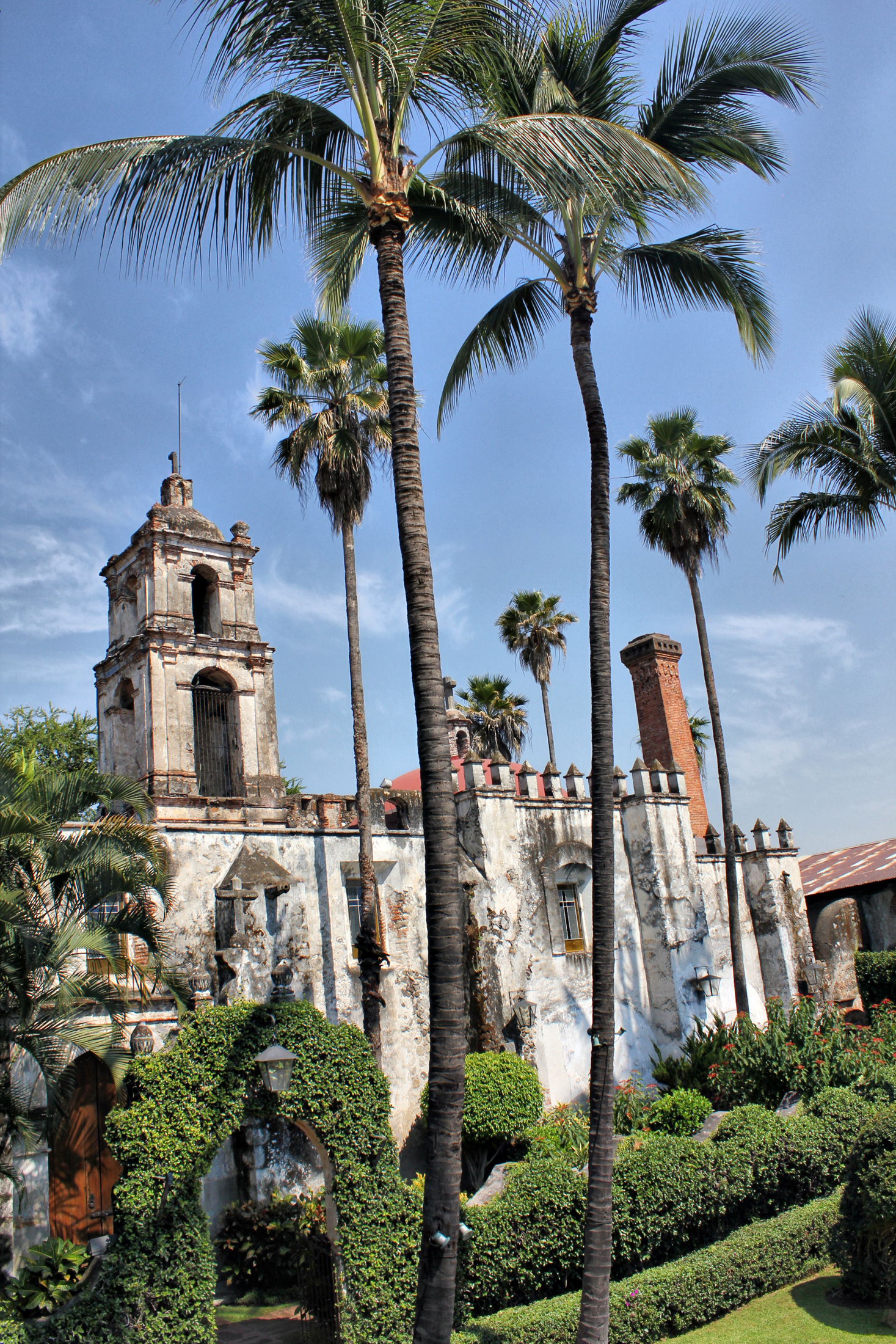
Town Temixco, Morelos Municipality of Temixco Southern Morelos
A city next to Cuernavaca with a 17th-century sugar ex-hacienda, water parks, a church from 1697 and the Assumption feast on 15 August.
From Cuernavaca: 25 min by car (26 km by road) How to get there ↓
Near here
Plan your visit to Temixco
Where to stay near Temixco
Compare hotels, posadas and guest houses in Temixco.
Tours to Temixco
Day trips around Xochitepec sometimes stop in Temixco; a tour is the easy way to see it without a car.
How to get to Temixco
- From Cuernavaca: about 25 min by road (~26 km)
- Nearest airport: Toluca (TLC), 1 h 59 min by car to Xochitepec
Links open a partner site. We may earn a commission if you book, at no cost to you.
About Temixco
Temixco is now a city in the Cuernavaca metropolitan area, about 6 km from the capital's centre and 85 km from Mexico City. The town had 104,461 residents in the 2020 census, most of the municipality's 122,263, which is the fourth most populous in Morelos. The name is Nahuatl: tetl, stone, mizton, cat, and co, place; "cat on a stone", which is also the municipal coat of arms. The elevation is around 1,240 metres and the climate is hot, with dry tropical forest on the hills.
The place's history is its hacienda's. The first works were a sugar press in 1617, and by the 18th century it was a sugar mill called Nuestra Señora de la Concepción, with cattle and timber as well as sugar and spirits. In the War of Independence it served as a royalist arsenal; in 1914 the Zapatistas took it to besiege Cuernavaca, and the fighting left much of it in ruins. In 1942 the government set aside 14 hectares of the hacienda to confine Japanese families from the region, who built wooden houses and grew rice and vegetables; the measure ended in October 1945 and some families, among them the Hiromotos, Yoshinos and Tominagas, stayed on. It later became a rice mill and, from 1968, a water park. The municipality was created on 3 March 1933 and the town was declared a city on 7 March 1990.
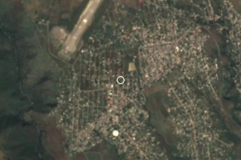
In the centre, the church of the Inmaculada Concepción, now known as the temple of Guadalupe, was built in 1697 beside the ex-hacienda. The parish of the Asunción, founded in 1952, is the mother of the area's other parishes, and its patron feast is 15 August, preceded by a novena, the "dormición" on the 13th and, on the 14th, the parade of the gallito with chinelo dancers and a band. Holy Week brings 13 processions with more than 150 years of tradition. With the heat and the closeness to Cuernavaca, the usual plan is the water parks: Ojo de Agua, with a spring and slides, and the ex-hacienda's, with 20 pools. The municipality also hosts Cuernavaca's airport, and in Cuentepec, another village in the municipality, 98 percent of people speak Nahuatl.
How to get to Temixco
Drive from Cuernavaca: 25 min, 26 km
Temixco sits on the way from Cuernavaca to Acapulco: the Autopista del Sol (95D) crosses the municipality north to south, between Cuernavaca and Xochitepec. From Mexico City it is about 85 km, and Wikivoyage puts the tollway to Cuernavaca at an hour and a half to two hours, longer on Friday afternoons or Sunday returns; Temixco is a few kilometres past it. The free road takes about 20 minutes more. From central Cuernavaca it is about 6 km, approx. 10 minutes; Xochitepec, the nearest pueblo, is about 6 km away, approx. 5 minutes. By bus, services run from the southern terminal (Taxqueña) to Cuernavaca, and the ex-hacienda water park's site gives Pullman de Morelos Temixco as its reference point. Within the municipality, the state roads Temixco-Emiliano Zapata and Acatlipa-Tezoyuca link neighbouring villages. Cuernavaca's airport (CVJ) is also in Temixco.
Directions to Temixco on Google Maps
Distances are in a straight line; the road is usually longer.
Links open a partner site. We may earn a commission if you book, at no cost to you.
From the nearest cities to Temixco
- Cuernavaca · 26 km by road, 25 min
- Cuautla · 82 km by road, 1 h 10 min
- Taxco · 78 km by road, 1 h 20 min
Drive times by road from OpenStreetMap, without traffic or stops. Times marked ~ are estimated from the straight-line distance.
What to see in Temixco 2
Sights with their own page, closest to the centre first.
Archaeological sites
-
Xochicalco · Archaeological site · 4 km from the centre
A UNESCO-listed hilltop city with the carved Temple of the Feathered Serpent, three ballcourts and a solar observatory cave.

Waterfalls
-
Cascada de Bedoya · Waterfall · 2 km from the centre
Waterfall in a Temixco ravine, reached on foot from Solidaridad; the pool is used for swimming and the trail has no services.
Map of Temixco
Neighbourhoods and villages of Temixco
Part of Temixco or just outside it, closest first.
-
San Agustín Tetlama · Village · 1 km from the centre
Old village of Temixco with 2,124 people at 1,289 m, near Xochicalco; its Nahuatl name means 'paper stone'. -
Eterna Primavera · Village · 3 km from the centre
Rural community in Temixco on the Cuernavaca boundary, at 1,318 m, with 1,088 residents in 2020. Not the 'city of eternal spring' itself. -
José María Morelos y Pavón · Village · 3 km from the centre
Housing-estate settlement in Xochitepec with almost 12,000 residents, beside Acatlipa and 12 km from Cuernavaca. -
Punta Verde · Village · 3 km from the centre
Temixco locality founded on 15 July 2012, with 1,703 residents in 2020, at 1,367 m and about 7 km from Cuernavaca. -
Benito Juárez (La Monera) · Village · 4 km from the centre
A locality of 771 people in Temixco, Morelos, known as La Monera, at 1,270 m, 6 km southwest of Temixco city and close to Xochitepec. -
Unidad Morelos · Town · 4 km from the centre
Housing estate José María Morelos y Pavón in Xochitepec: 11,805 people in 2020, the municipality's second-largest locality. Not the IPN campus.

Day trips and tours from Temixco
The closest Pueblos Mágicos and places to visit, with the drive from Temixco and tours that leave from it.



Times marked ~ are estimated from the distance. Links open a partner site. We may earn a commission if you book, at no cost to you.
Before you go: getting to and around Temixco
- The nearest airport is Toluca (TLC).
- The best months to go are January, February, November, and December.
- 3 of the places on this page are more than 3 km from the centre: take a taxi, a ride-hailing app or a local bus.
- For day trips a rental car gives the most freedom; the tours above leave from Temixco.
Before you go to Temixco: hours, prices and tips
- Hours
- The ex-hacienda water park is open every day of the year, from 9:00 to 18:00. Balneario Exhacienda de Temixco (sitio oficial) · checked Oct 2026
- Best season
- Patron feast of the Assumption from 6 to 15 August (novena, dormition on the 13th, gallito on the 14th, main feast on the 15th); Holy Week with 13 processions; municipal anniversary on 5 and 7 March. Wikipedia (es), Municipio de Temixco · checked Oct 2026
Hours and prices change, especially around holidays. Each fact links to where we checked it.
Visiting Temixco: what to see and do
The Temixco ex-hacienda, a 17th-century sugar mill, and the temple of Guadalupe (1697) beside it.
The parish of the Asunción in the centre, whose feast is 15 August (with a novena, procession and gallito on the 14th).
The 13 Holy Week processions through the centre.
Balneario Ojo de Agua, with a spring, slides and children's pools.
The ex-hacienda water park, with 20 pools, a wave river and slides.
Xochicalco, the archaeological site, which the municipal attractions list also includes although it lies in Miacatlán.
Plan your trip
Places to stay in Temixco
Compare hotels, posadas, and rentals in and around Temixco.
Tours & activities
Day trips around Xochitepec sometimes stop in Temixco; a tour is the easy way to see it without a car.
Rental cars
Pick up a car at TLC (Toluca): about 1 h 59 min by road to Xochitepec, then 6 km more to Temixco, on your own schedule.
Flights
The nearest airport with scheduled flights is Toluca (TLC), about 1 h 59 min by road from Xochitepec, the base for Temixco.
Mobile data
Signal can drop away from Xochitepec: download a map of the way to Temixco before you set out, or carry an eSIM with data.
Links open a partner site. We may earn a commission if you book, at no cost to you.
When to go to Temixco warm
Temixco shares the climate of Xochitepec, 6 km away. The best months to visit are January, February, November, and December.
See the month-by-month climate of Xochitepec
Weather in Temixco now and the next 7 days
Live forecast from Open-Meteo. Chance of rain is the day's highest.
The closest Pueblo Mágico: Xochitepec

Xochitepec is the Pueblo Mágico closest to Temixco, with places to stay, food, and more to see.
Also close to
- Tlaltizapán · Morelos · 23 km away
- Tepoztlán · Morelos · 25 km away
- Malinalco · Estado de México · 26 km away
- Tlayacapan · Morelos · 34 km away
- Ixtapan de la Sal · Estado de México · 41 km away
Near Temixco







Drive times by road from OpenStreetMap, without traffic. Times marked ~ are estimated from the straight-line distance.
Location from OpenStreetMap. Written by Puebloteca.